
Map Miles: Today: 19.4/ Total: 207.3
GPS Miles: Today: 21.8/ Total: 225.3
Today’s Miles Sponsored by: Dick & Debie, Dani, Mary Kay & Nick, Elizabeth
The headache is still there. It’s been a constant pressure above my eyes all day. Worst when I lean forward. My ear pressure is still clicking on and off too. I definitely have developed a sinus infection and I’m going to need to try to find something to help with that in Hanksville tomorrow.
It was cold last night. While I was more than toasty warm in my sleeping bag and puffy, my water actually froze a little in my bottles. I wasn’t expecting it to get that cold. It makes me nervous for my water filter- it can break if it freezes and usually I cuddle with it in my bag when I know it’s going to be cold. I didn’t last night…
Since I wasn’t feeling at top game, and since I was back on pace with my schedule, I tried to take a more leisurely pace today. I didn’t push extra hard and took lots of breaks. That was helpful because the majority of the day was cross country, which always takes longer.
First I wove back and forth up the washes and ridges of the Red Benches, seemingly at random. The landscape didn’t have a ton of definition, just lots of small hills with red dirt and green shrubs. Because of the lack of features there are actually 4 different mapped routes/ GPS tracks through this area!

Red Benches
Eventually after a few miles I made my way up to an old cowboy cairn – probably 8 feet tall? It looks like a giant game of jenga. I took a nice long break here really wondering about who built the cairn, when, why, all of the regular questions I seem to ask myself all the time.
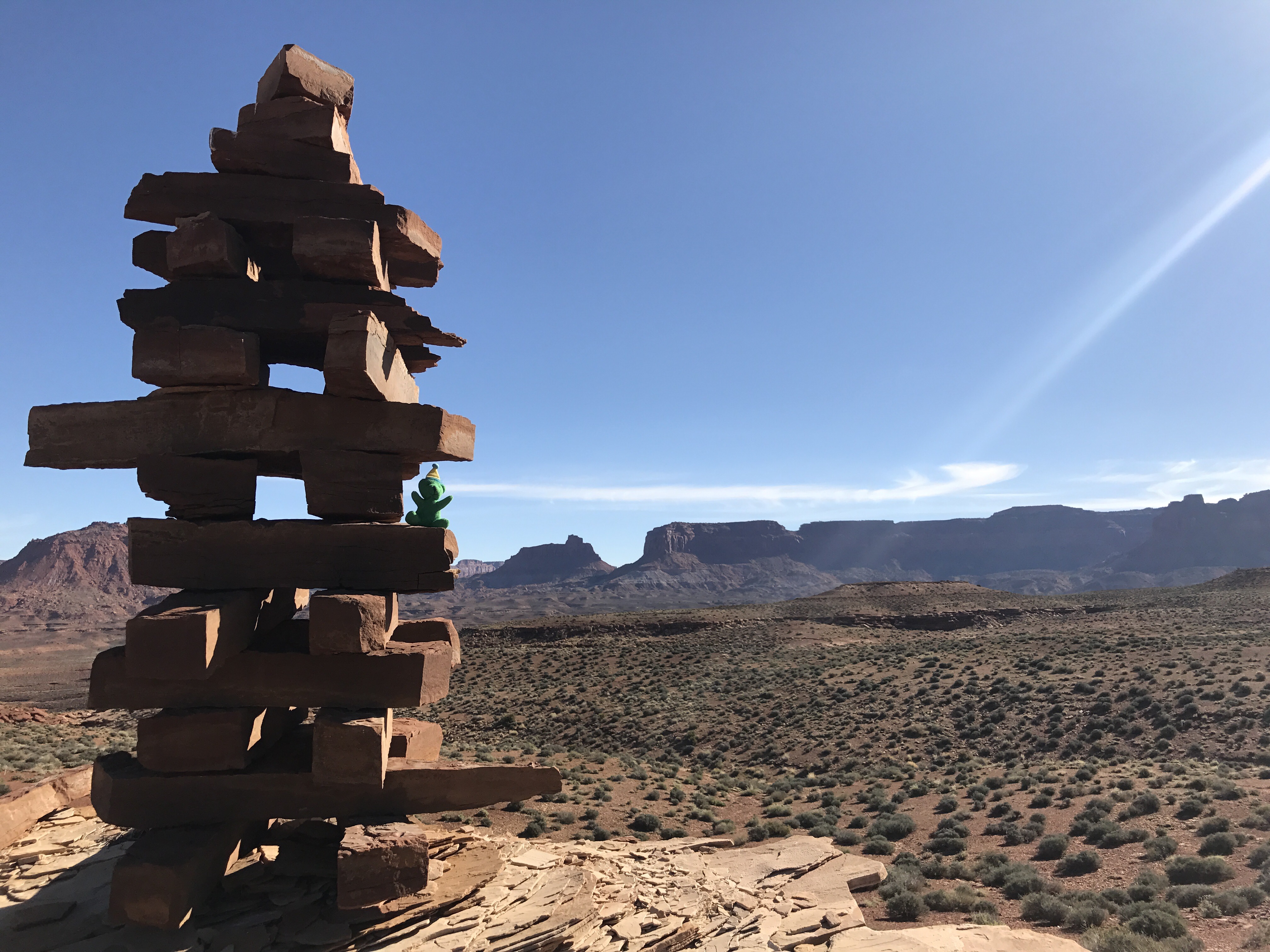
Giant cowboy jenga cairn
From there the route finding got a lot more straight foreword following the ridge lines to the one place it’s possible to drop into Fiddlers Cove Canyon. What an amazing view! So different than the other canyons we’ve been in. Really dramatic tight curves with huge spires in the center- super neat.
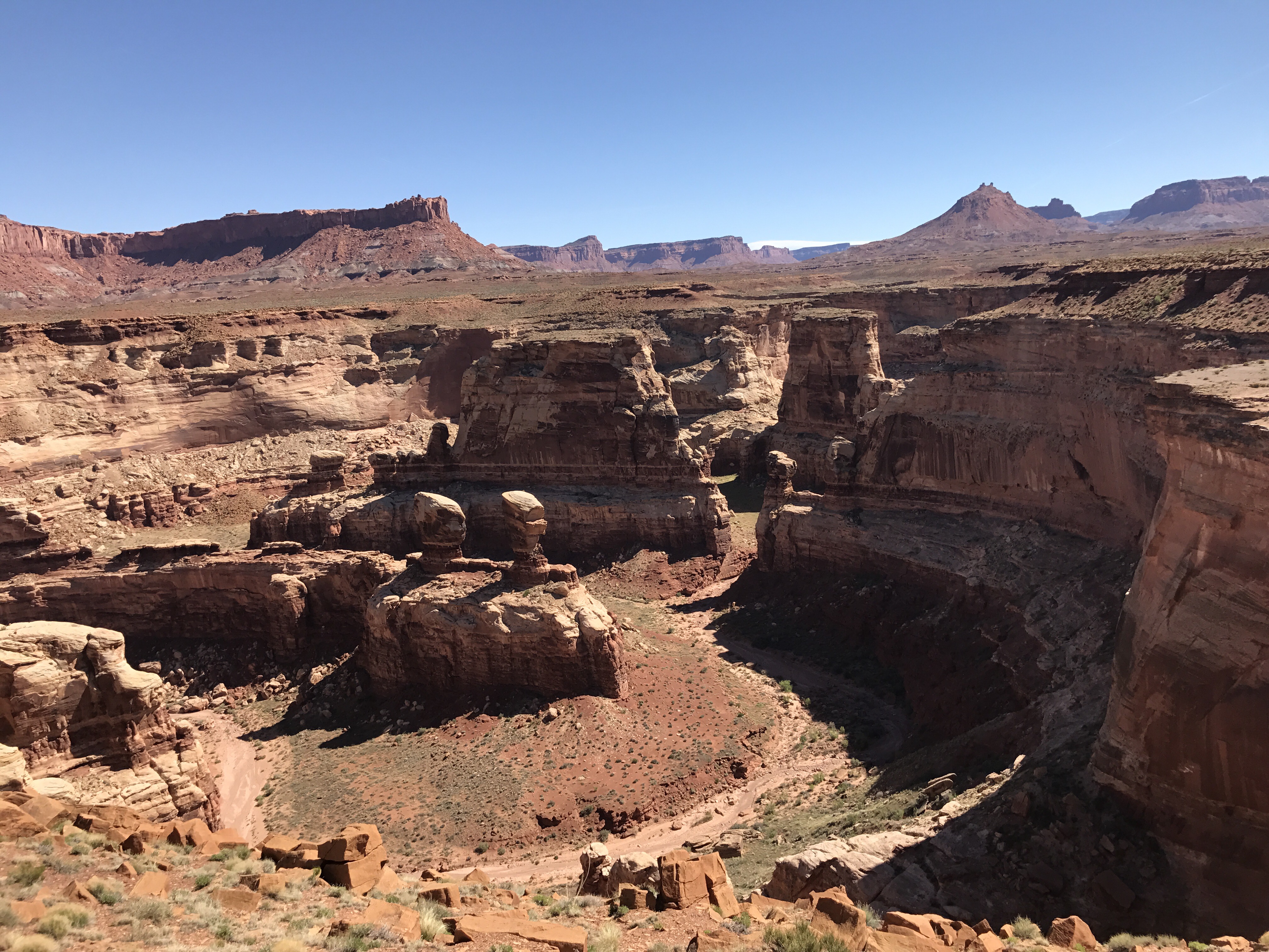
Looking up canyon in Fiddler’s Cove
I dropped down the 750 feet into the canyon and passed this awesome skull on the way down. I think sheep? Can anyone help clarify?
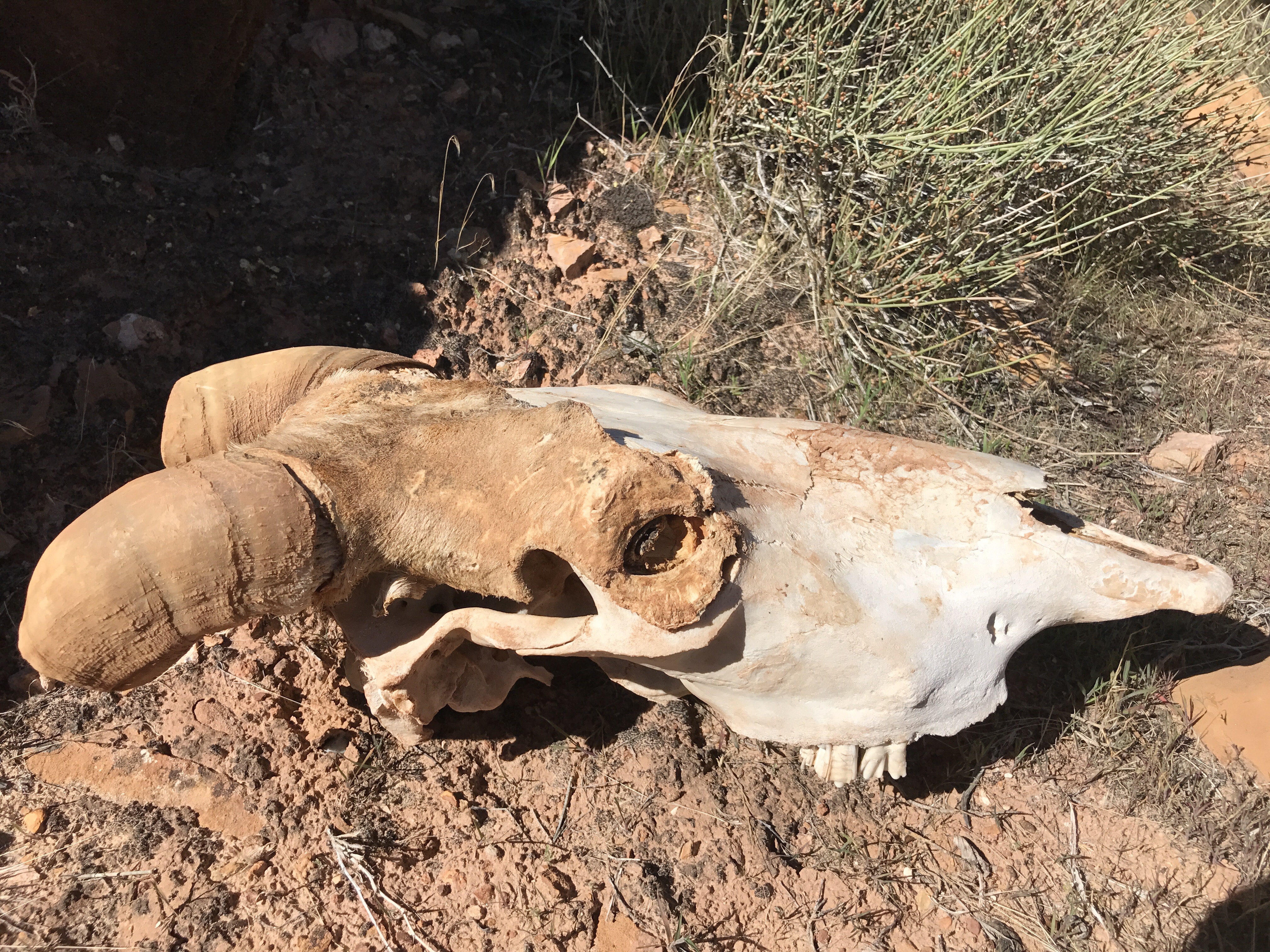
ID help please?
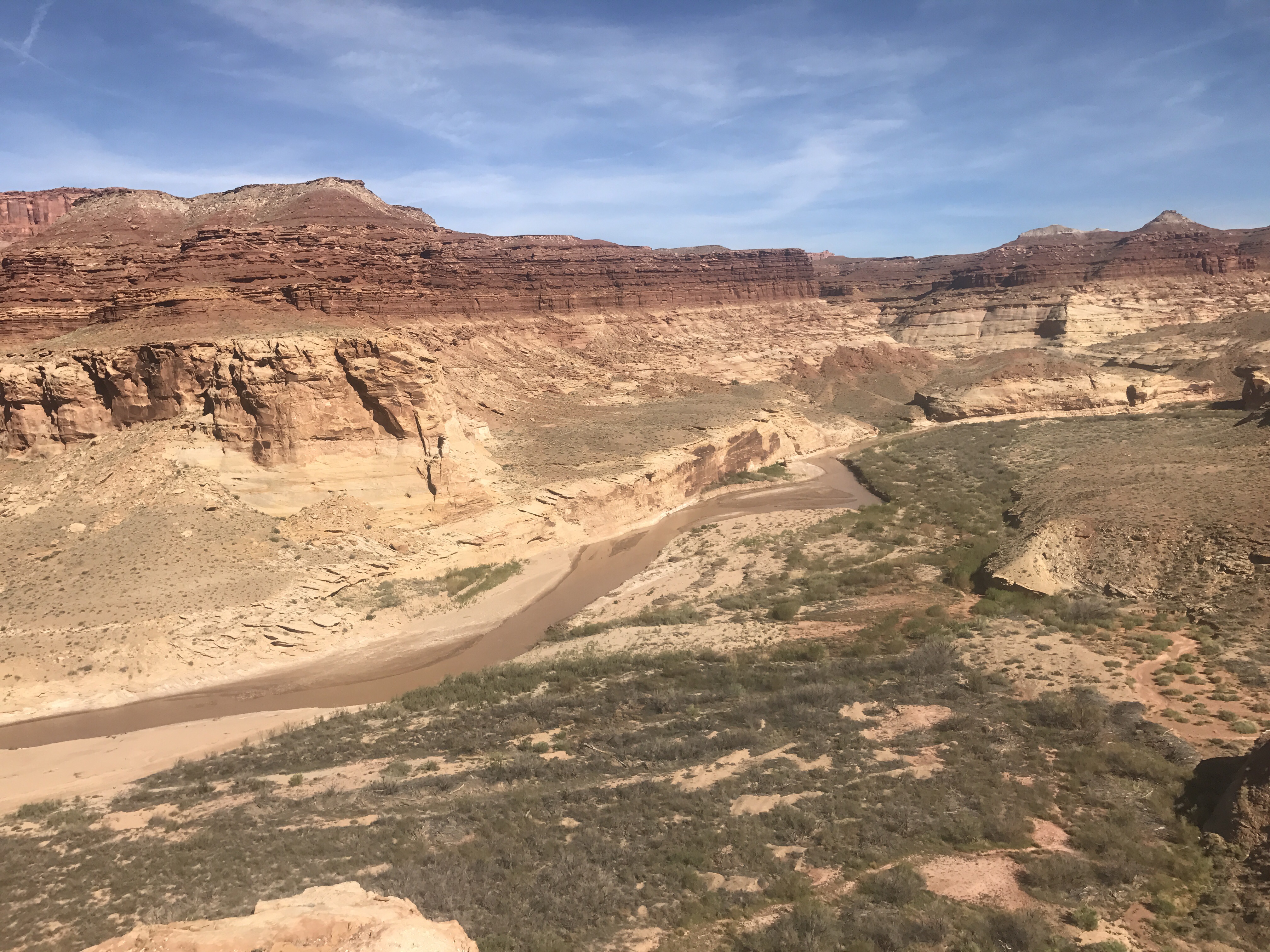
Into the canyon and down Fiddlers Cove brought me into the Dirty Devil land. This is probably the biggest river save the Colorado I’ve dealt with so far. The route followed it upstream for something like 5.5 miles. You’d try to follow as far as you could in the sandy old river beds or rocks, but eventually would get cliffed out and forced to ford. It’s not too wide- but it’s silty brown (and filled with agricultural waste and hard metals) so there’s no way to gauge depth. It’s banks are also filled with mud and quicksand. More than once I nearly lost a shoe and that was just on shore!
Fording took some time. Trying to find a narrow spot but that also might not be too deep. I’d try to test depth with my trekking poles, but a place that would be knee deep in the poles would end up being hip deep when I’d step down as my foot became enveloped in the mud. Needless to say it took a while – back and forth, back and forth.

Totally staged.
I was surprised though when I ran into a standup paddle boarder and his buddy in an inflatable catamaran. They were on Day 4 down the Dirty Devil from Hanksville. The paddle boarder was getting by pretty well, but the catamaran didn’t have quite enough depth to float.

Floating the Dirty Devil
After nearly losing my shoe again in another ford, I was kinda done with the river. I looked at the GPS and noticed an alternate track that Nic Barth developed. It got me out of the river about a mile early and went up to see an old uranium mine. Score! Dry land and local history! I was so excited I left the river a little too early and ended up doing a few PUDs but finally got on track and up and away. Up top was a great view back down towards the river.
Glad to be above and not in the Dirty Devil
From there an old jeep road appeared and then the broken down shacks of the miners. About 1000 feet up the road was the mine portal and another shack still standing.
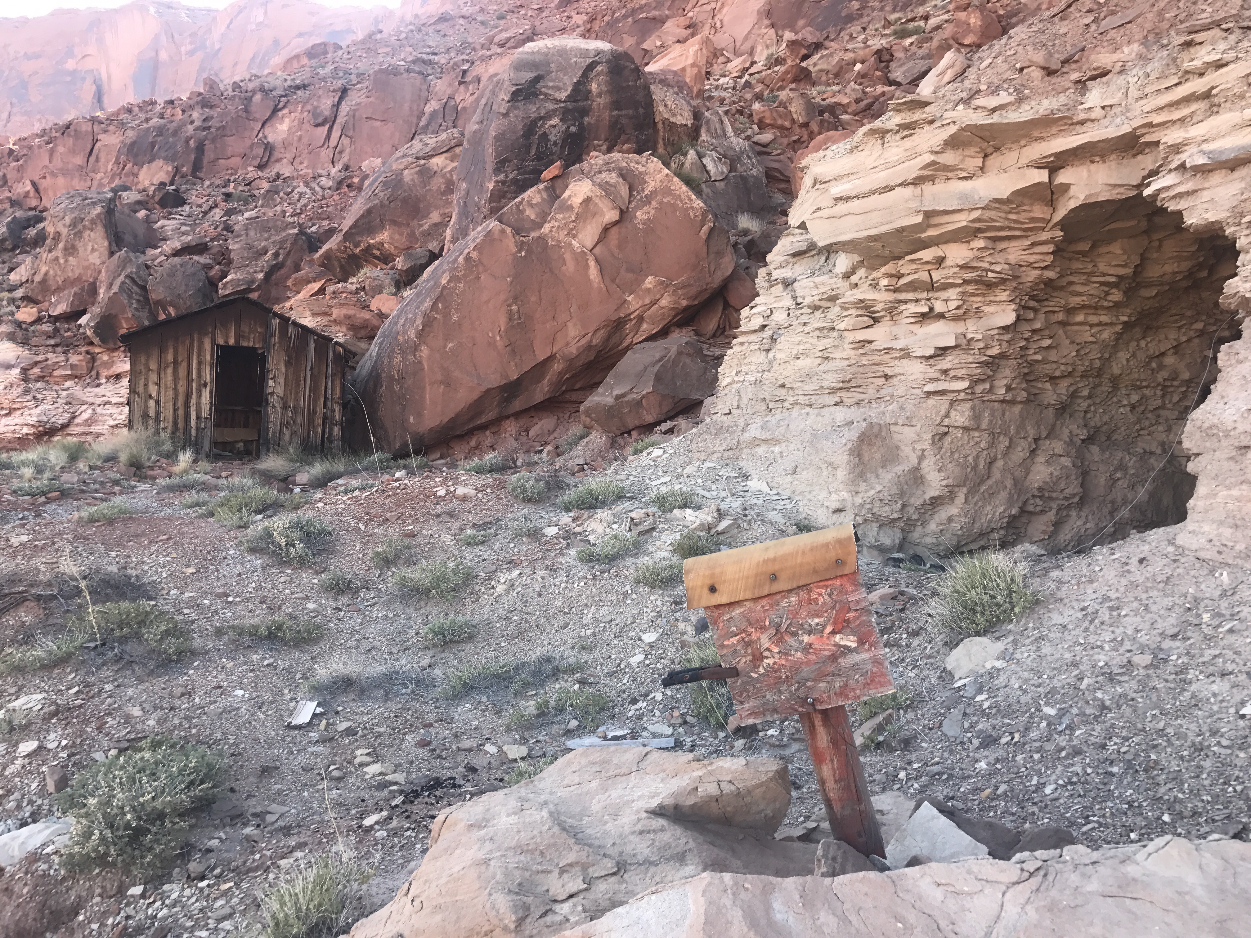
Mine Portal
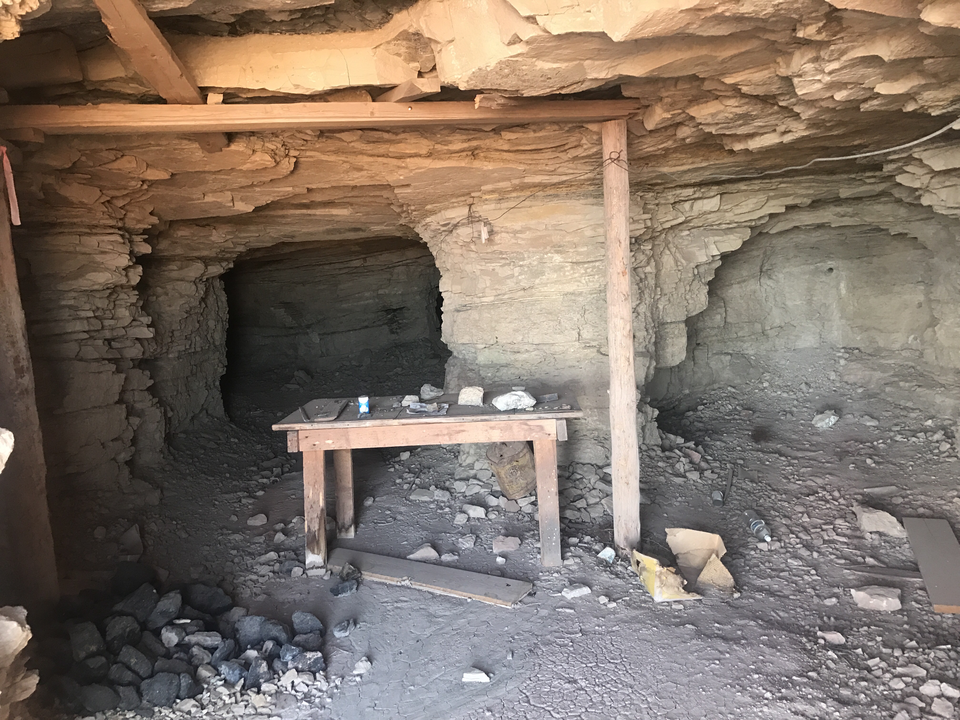
Into the mine shafts
Heading back down the jeep road I eventually connected back with the guidebook route on Poison Springs 4 wheel drive road. At some point 2 ATVers zoomed by (and then 3 more after dark that I saw from my camp). It’s so neat seeing how many different ways people use their public lands.
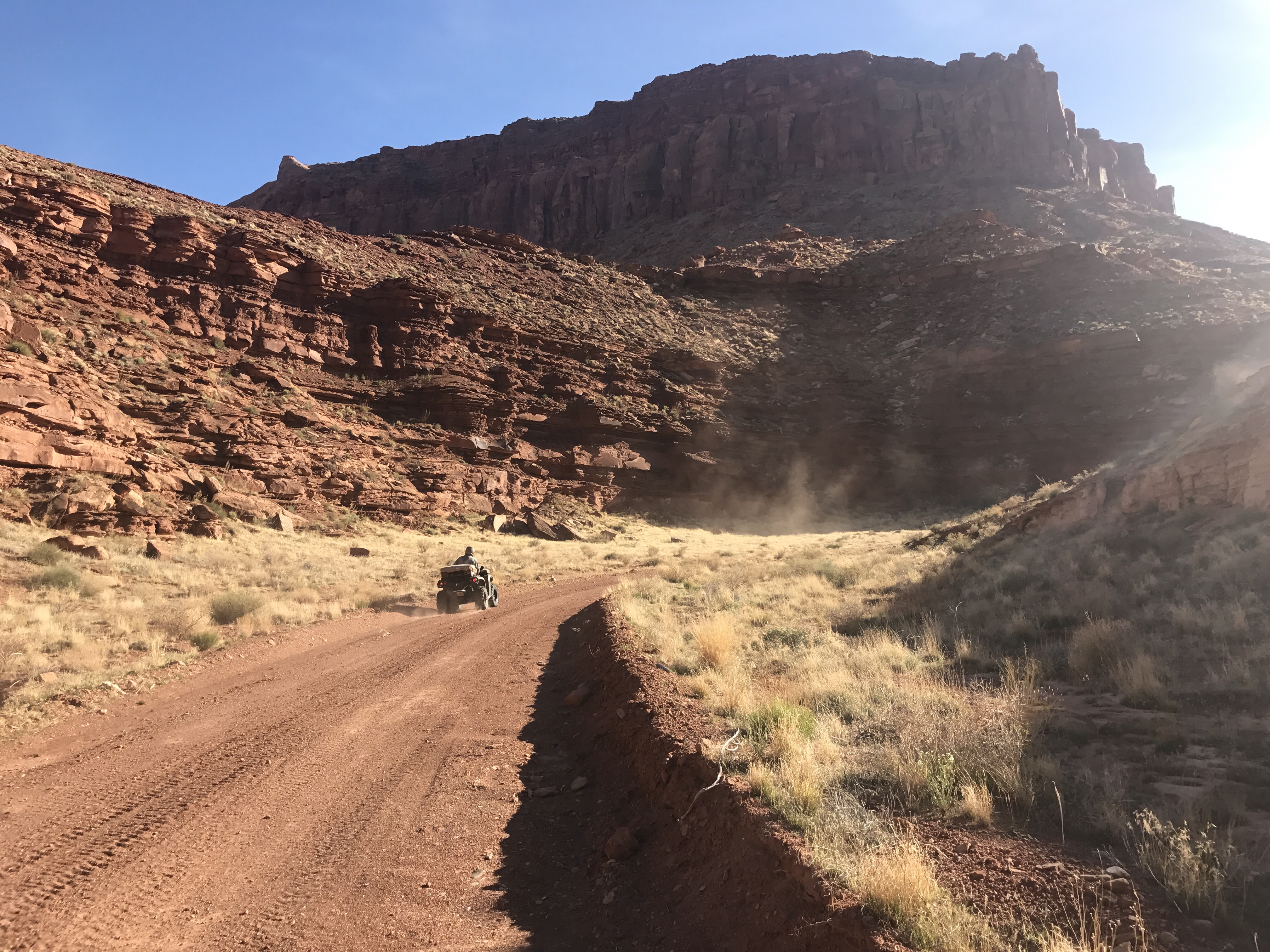
ATV zooming by on Poison Springs Road

Cowpie Camp at Black Jump
