
Map Miles: Today: 21.7/ Total: 265.5
GPS Miles: Today: 22.1*/Total: 287.9
*I added 3.5 miles to the total which is approximately what was missed when my GPS randomly turned off mid-day
Today’s Miles Sponsored By: Jim, Jennifer, Karen, Peter
There was frost on the inside of my tent this morning instead of the usual condensation. It must have been another crazy cold night! Since I got in so late last night I saved making water for this morning and when I got over to the trough I actually had to break up the ice that had formed on top to get any. I filled up a bunch of water here as most of the water sources for the next 40 miles included descriptions like “cow infested” and “manky mud hole” it took forever to fill though because my squeeze pouch has sprung a leak. With that broken and my sawyer possibly frozen anyway I’m going to see if I can get a new one in Escalante.
With so much time devoted to making water in the morning, I didn’t actually break camp until 8! That’s so late for me! I know I’m not in the Grand Staircase yet, but that certainly is what the landscape felt like today, dropping from level to level to level…including yesterday’s descent from Mt Ellen it’s pretty huge!
I started with a few more easy dirt road miles on Tarantula Mesa, looking across the way at the Waterpocket Fold where I hoped to end my day.

Easiest Miles of the day
Soon the route led off of the roads and over to (and down) the cliff to the next level.

Super slidey rocks on this descent.
The rocks on the descent were pretty loose which made the travel cautious. It left lots of time for admiring all of the different amazing layers of rock I was going through. At the bottom of the cliff ( and for many of those around) there was a final layer that I think can only be described as giant mounds of hardened dirt.
The tall cliffs of Tarantula Mesa now hovered above (and the Henry’s above it). I found myself winding around randomly through a maze of small canyons and washes. Sometimes right under the large cliffs, sometimes in smaller canyons that gave you no sense of the surrounding view. Up one draw and down another. I felt like I was drawing letters with my track- “W” and “S” mostly. One of the canyons had some pretty gnarly clay-y mud in it too. My shoes were caked in the red muck.

In and out of the maze of canyons
When I stopped for lunch I discovered that my GPS has mysteriously turned off at some point, which meant I hadn’t caught any of this winding track. Sad!
After lunch my energy sagged. I stopped for a lot of small breaks, especially to dump all of the sand out of my shoes and socks. If it was just the shoes that would be one thing, but all the sand inside the socks makes for super duper annoying (and sometimes painful) walking. My pace dropped as I dropped (again) into Swap Canyon, where I filled up two “just in case” quarts at the “manky mud hole” spring
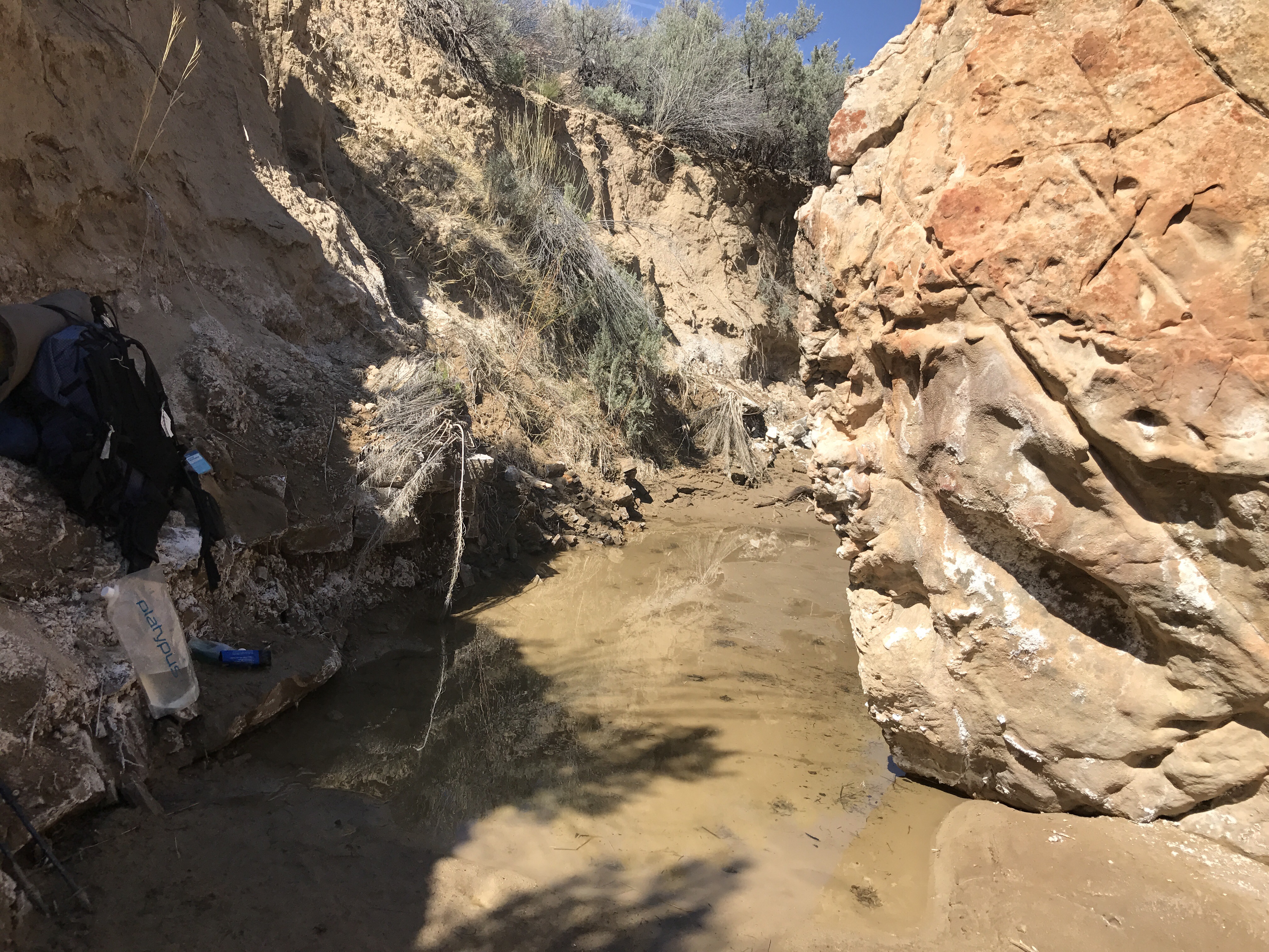
The mud hole spring didn’t look as bad as some I’d seen, but it still wasn’t fantastic.
Slowly plodding along, the day seeping past me, I livened up a bit when I hit the Capitol Reed National Park Boundary.

Welcome to a new park!!
The trail goes through the Southernmost part of the park, which is designed to mostly protect the Waterpocket Fold- a 100 mile slickrock wrinkle in the earth that bends and folds and twists up and out in a multitude of colors.
I Emerged from Swap Canyon into the Grand Gulch, a north-south trench that parallels the high Waterpocket Fold. In the Gulch, the route hit the Burr Trail. Originally a cattle trail from Boulder, Utah to Bullfrog, Utah, it eventually continued to widen and broaden its use until much of it was controversially paved in the late 80s. It ascends the Waterpocket Fold in a number of steep switchbacks – which was what we did too!

Ready to go up!
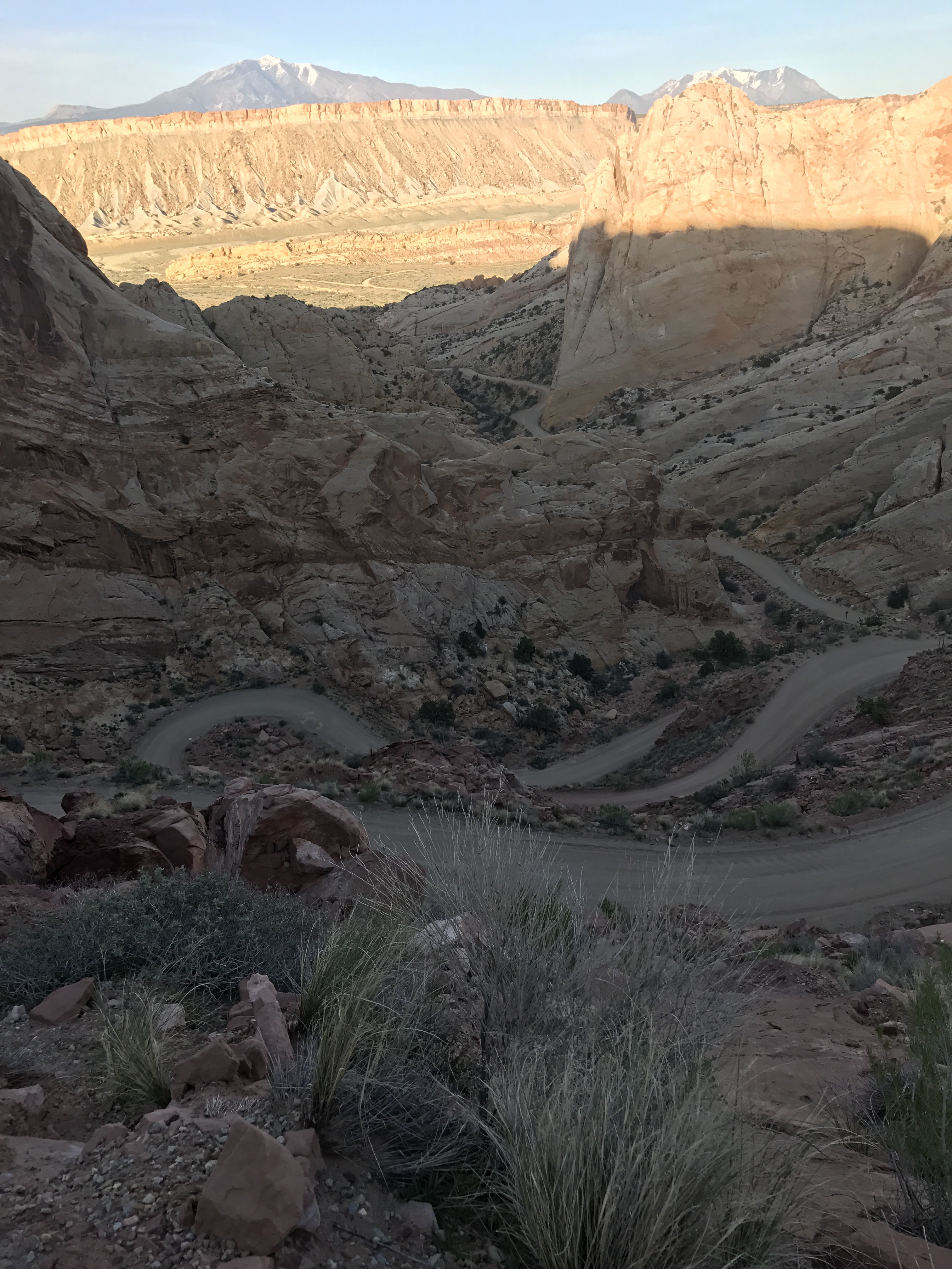
Two thirds of the way up the narrow switchbacks.
At the top of the Fold was a small picnic area where a fellow traveler from Seattle was sitting in his truck just finishing up his dinner and admiring the view. He was out biking the area for his spring break. He very kindly gave me 2 quarts of fresh water so I could dump the mud hole supply, and then took off leaving me with the beautiful view- which is pretty amazing. You can see each of the different layers of the area I’ve been on in just the last two days.
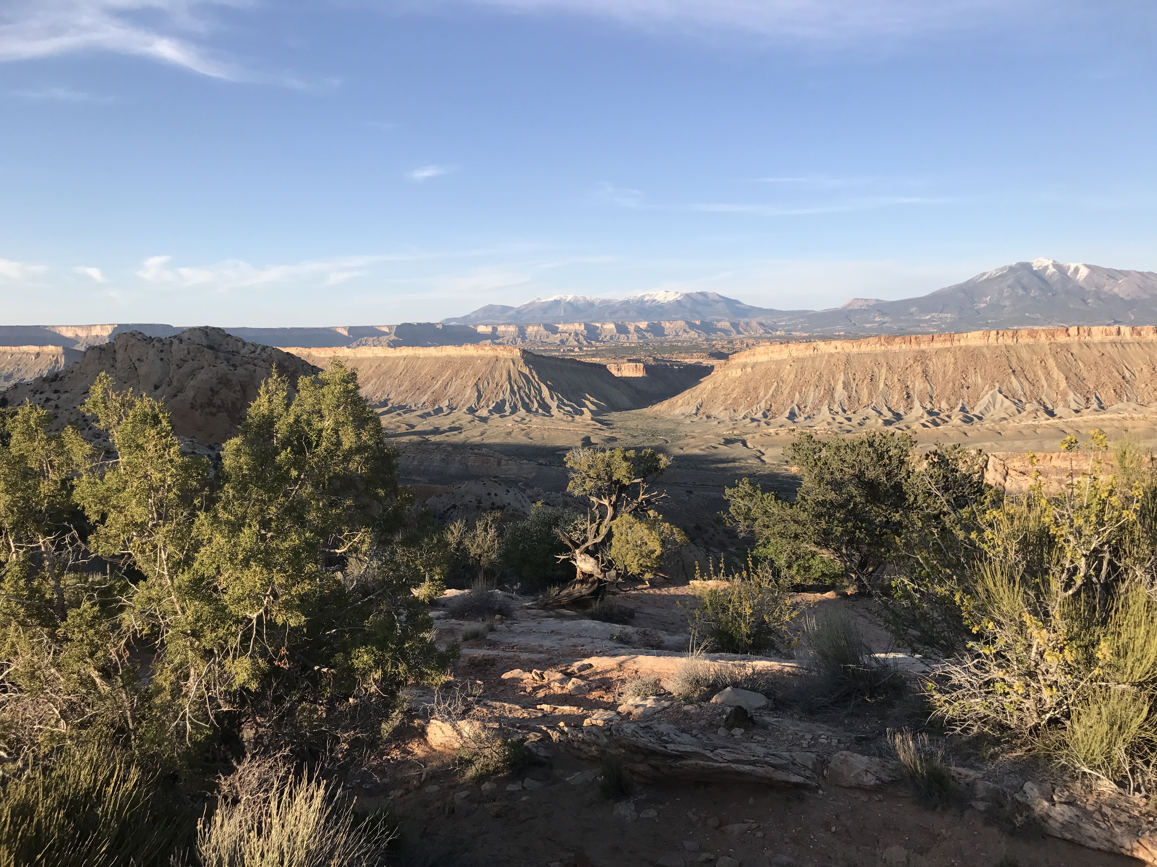
Looking back over the many levels- the Grand Gulch, Swap Canyon, the broken canyons of Swap Mesa above, Tarantula Mesa above that, and the Henrys towering over all.
It’s warmer here, so I’m excited to cowboy again tonight. After two nights in the tent it feels good to reconnect with the sounds of the world.

Another awesome camp spot
