
Map Miles: Today: 16.4/ Total: 775.8
GPS Miles: Today: 18.9/ Total: 818.7
Today’s Miles Sponsored By: Kevin, Anonymous, Ben, Rebekah, Max, Sabrina, Sarah
The packing process took much longer then usual this morning in the cold air. When I finally left the rim at noon, I don’t think it had gotten above 45 degrees yet for the day.
My main morning task was to figure out what was going on with my InReach and charge my electronics. I had struggled with that yesterday. I never found a place that was a) inside with b) an outlet and c) cell/data reception. I could only ever find some combo of the three.
I had lots of time this morning because of the new itinerary I worked out with the backcountry ranger yesterday. I had a few reasons for wanting to change it.
Originally I’d been planning on taking an alternate to the guidebook route that would have kept me on the Tonto Plateau for another 50 miles before dropping to the river and catching another ferry hitch back across. After these last few days on the Tonto that no longer sounded appealing. Yes, it would have been more time in the main Canyon, but there’s also something to be said for time spent in the Kaibab. One of the things I appreciate about this route is the diversity of experiences on it. A high altitude ponderosa forest is unique to this area, so while I wasn’t thrilled about a 25 mile road walk, I felt like it all balanced out.
And then there was the issue of the Tapeats. A short crosscountry section of the route first goes through what is supposed to be an awful bushwhack, down some plunge pools, and then wading knee deep for a few miles through Tapeats Creek. Except Tapeats is running too high right now, and actually swept away a woman and her grandson who were trying to cross it about a month ago. So an alternate route for that was needed too.
And finally, there was Brighty. Christa and I like to read bedtime stories out loud to each other, and before I left for this trip we started reading “Brighty of the Grand Canyon” by Marguarite Henry. A semi-true story about a burro who lived on the north rim during the early twentieth century, gave rides down to the bottom for kids, helped Teddy Roosevelt hunt cougar, and was the first to cross the bridge across the Colorado River connecting the North and South Rims. We actually finished reading it together over FaceTime in Kanab.
Sentimentally I wanted to hike up Bright Angel Creek. See Brighty’s terrain. Explore the meadows he grazed during the summer. See if I could spot an old mine and pretend it was Old Timers. Maybe even hike out to Uncle Jim Point if I had the extra time. It felt like I could bring Christa into a small part of the hike.
So for all those reasons, I reworked my itinerary, leaving me an easy 16 miles to Cottonwood Camp, half way up the North side. It also meant I didn’t need to try to carry 8 days of food Rim to Rim in a day, which I was feeling a little anxious about. (Though sad to not do the iconic rim to rim in a day…alas another time)
Wow, that was a lot of explanation! I should get to the trail, huh? I got through to DeLorme and got the InReach working again (woo-hoo!) and was thankful to be leaving the cold south rim just after noon.
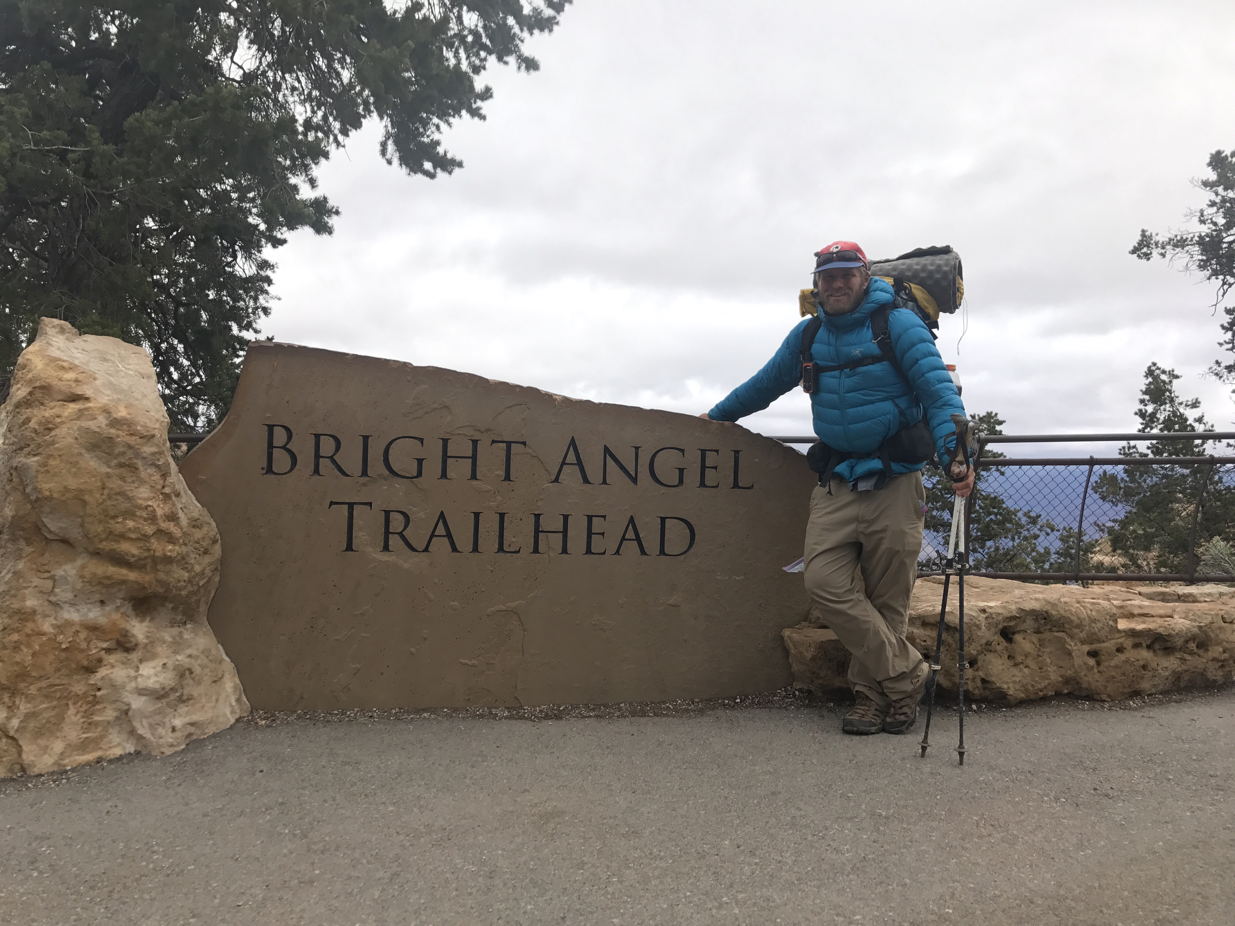
Getting ready to head down the trail.

Waiting for the mules to pass.

Serenade on the trail.
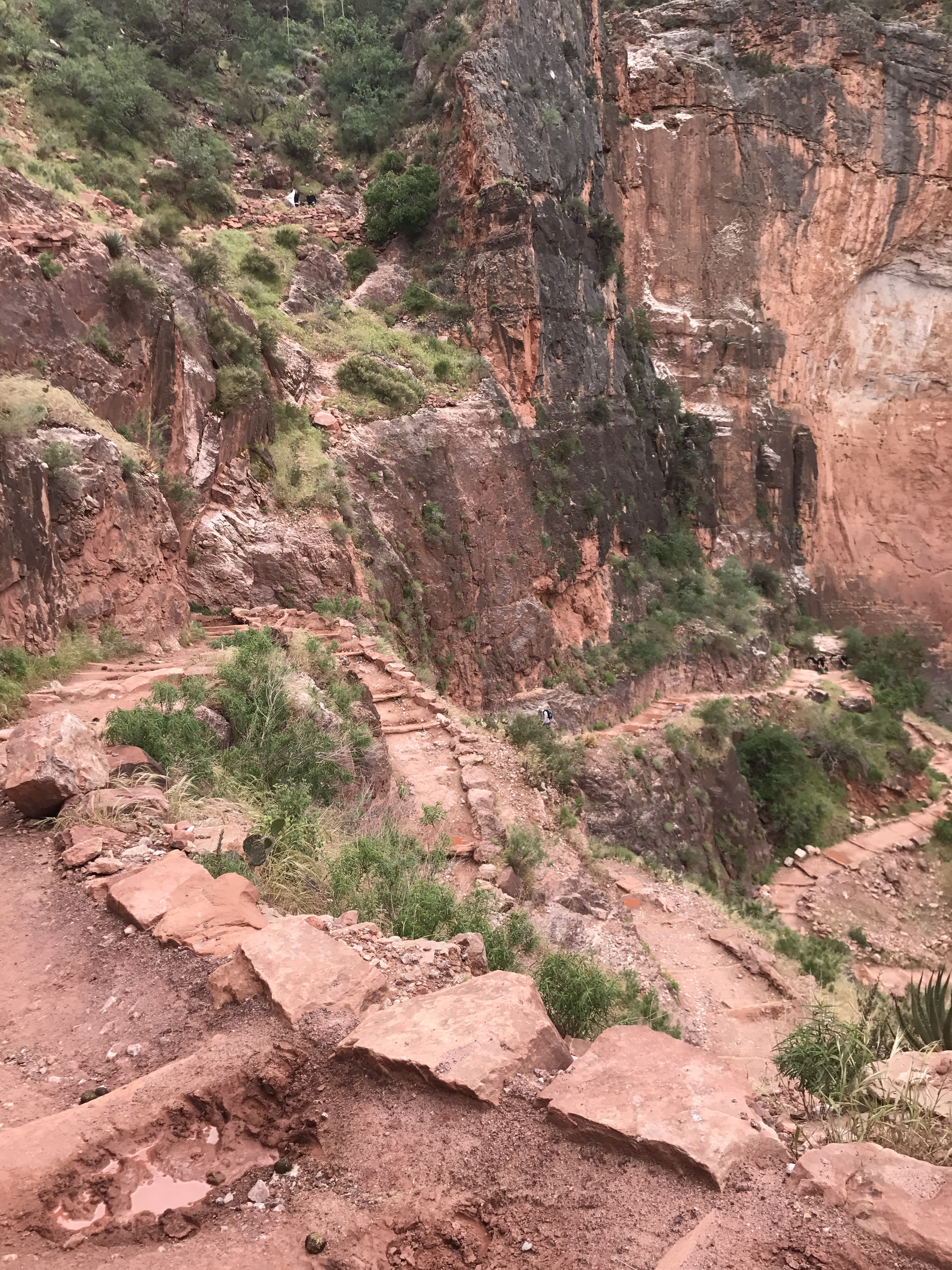
Switchbacks heading down.

Waterfalls along lovely Garden Creek.
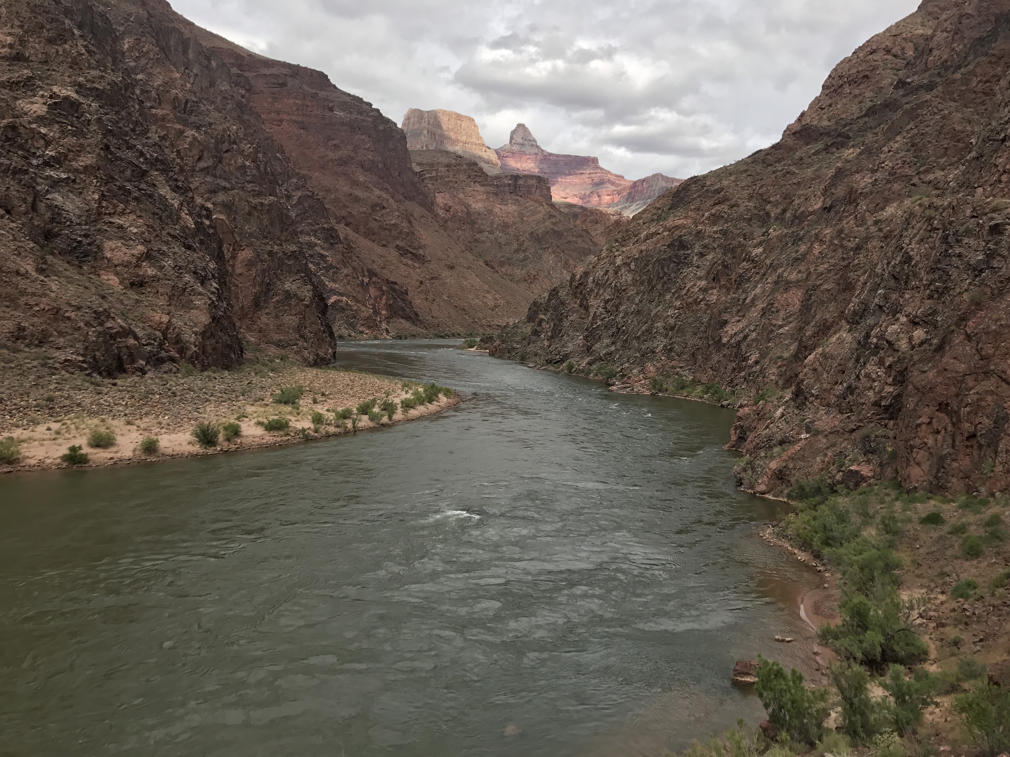
Back on the magical Colorado!
I crossed the Colorado on the silver bridge, which was built in the 60s to carry the TransCanyon pipeline across to the South Rim. The Black Bridge, while not the original swinging suspension bridge Brighty originally crossed, is in the same location about a half mile upriver.

Lydia’s Geopet crossing he Silver Bridge. The older Black Bridge is visible in the background.
And then it was time to push on. 6 miles up the trail to Cottonwood Camp. An easy almost flat stroll through the narrow section of the Bright Angel Creek.
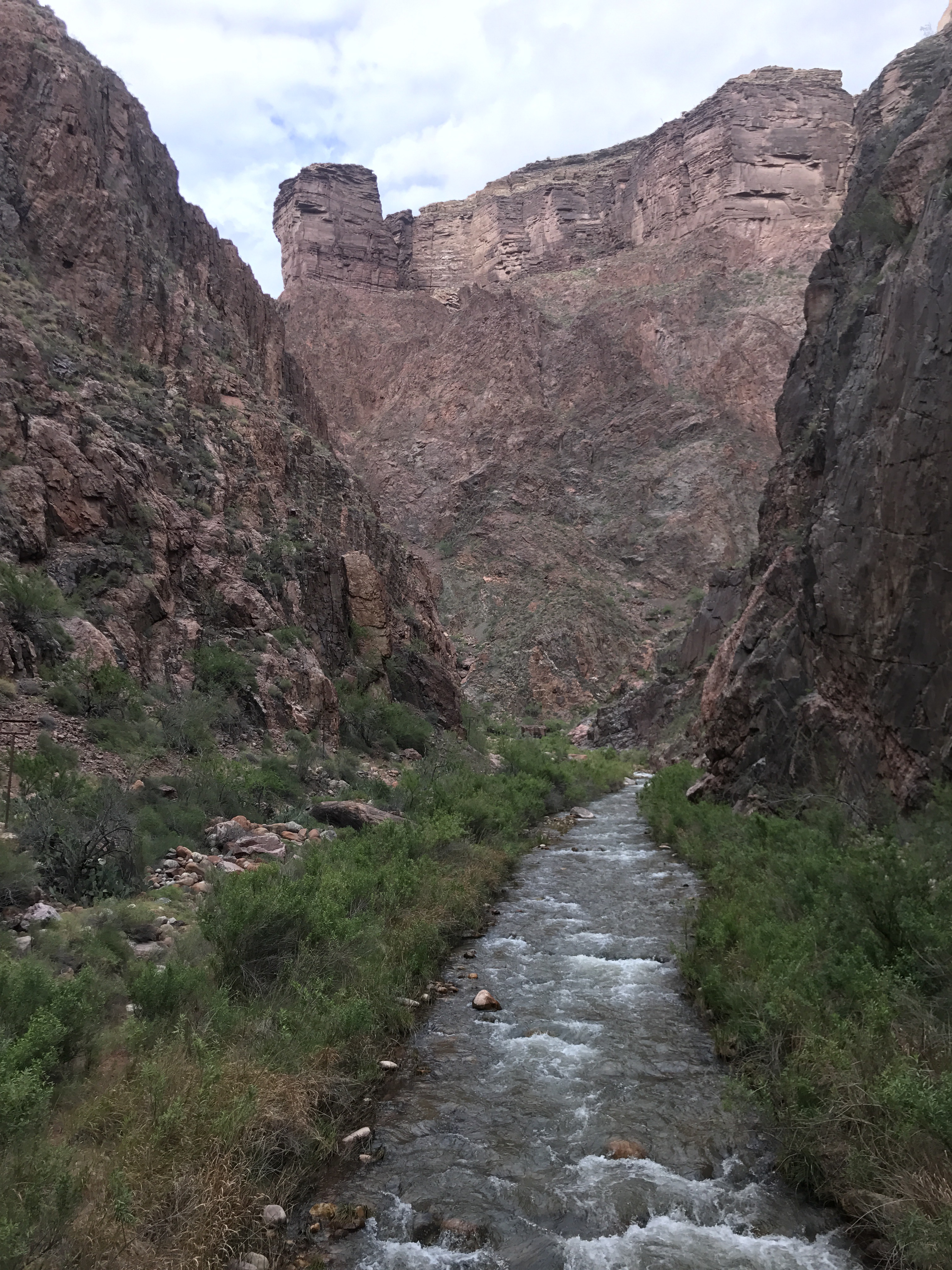
Along Bright Angel Creek imagining Brighty leading the way.
Out of the fantasy world, I also marveled at the modern touches we’ve added to the Canyon. The trans canyon pipeline was built in the 60s and starts at Roaring Springs on the north side and provides all the water for the North and South Rims. And then there’s that transcanyon phone line constructed in the 1930s by the CCC.

Both the transcanyon pipeline and transcanyon phoneline are visible in this photo. What awesome feats of engineering! I can’t imagine how difficult they were to build.
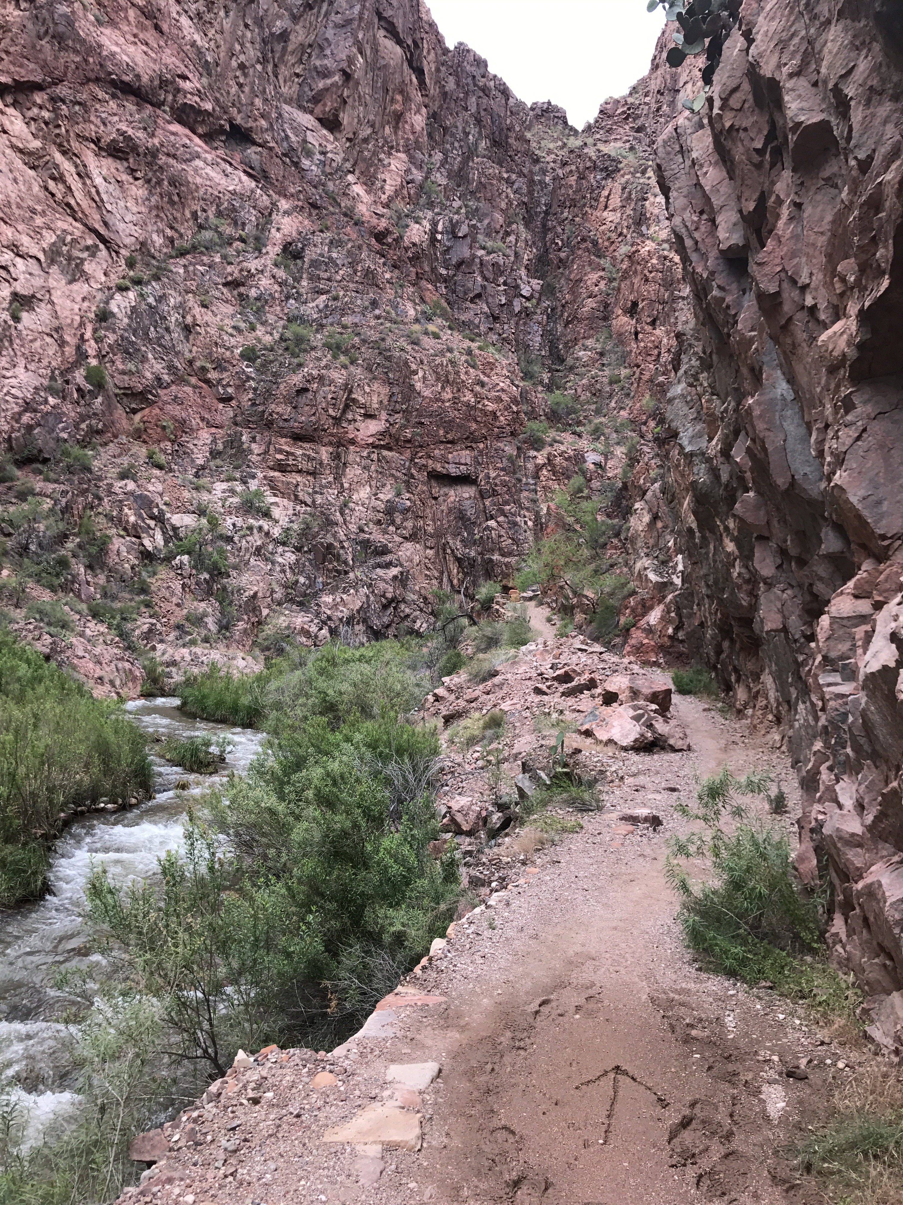
Dirt arrows (and smiley faces in some spots) pointed the way up-canyon.

Looking back on the greener slopes of the North Rim canyons.
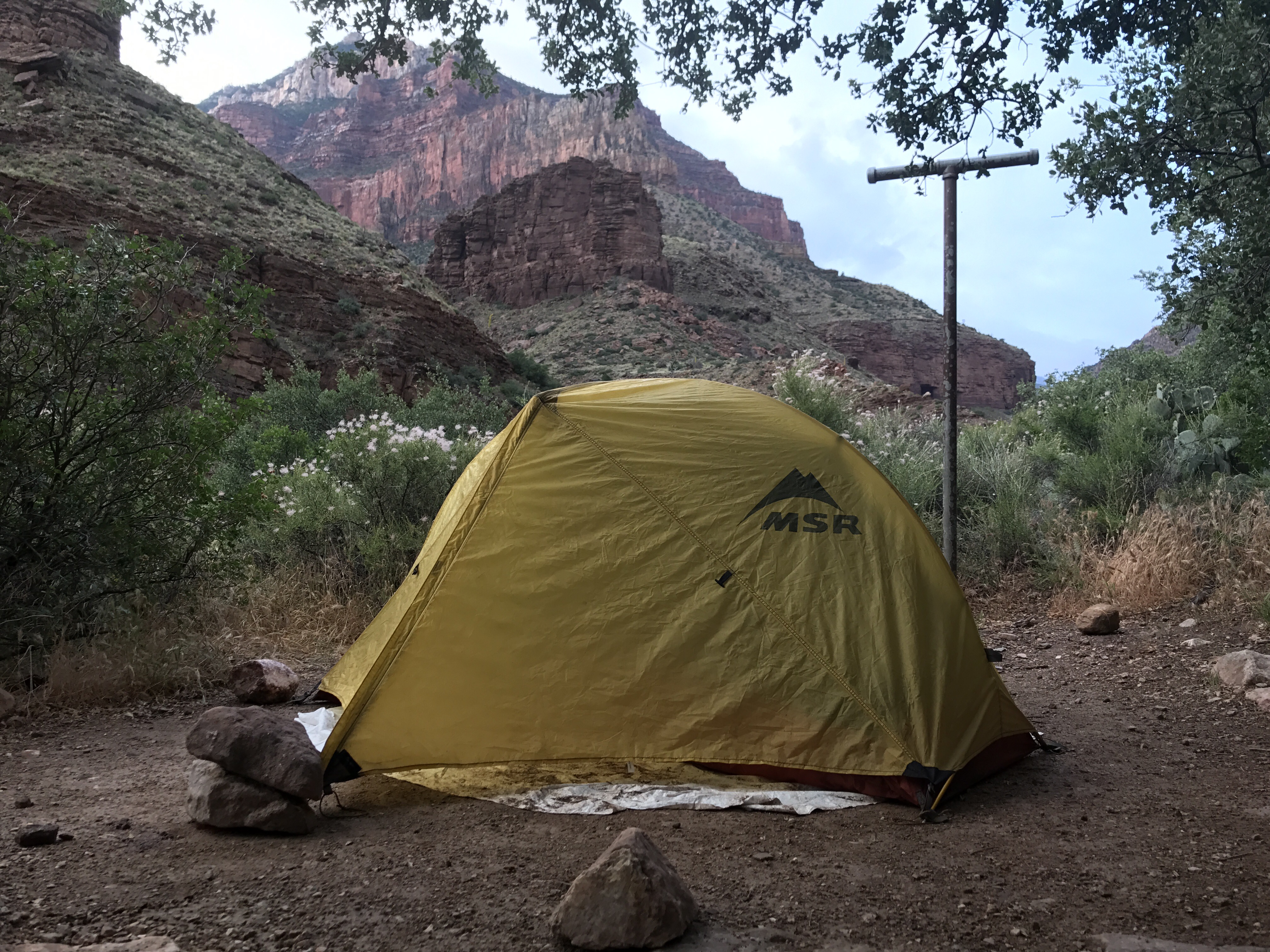
Hoping for a dry night.
