
Map Miles: Today: 18.9/ Total: 474
GPS Miles: Today: 18.9/ Total: 502.7
Today’s Miles Sponsored By: Teresa, Karen, and Chilidog
Awful nights sleep. Probably about the worst I’ve had on this trail. Just as I was settling down. The wind kicked up. I was lying in my tent and it was catching it and tossing it sideways. I was having flashbacks to my Glacier Peak trip this last summer…except this time I’d be inside the tent as it blew away. And the sand. The fine sand would blow in through the mesh. Everything was covered in a thin blanket of it this morning and no matter how much you shake the tent, you just can’t get it all out.
I took a bit of a slower time getting ready this morning as I shook the sand out of everything. It was also pretty chilly which always makes it a bit harder to want to move. The temps dropped into the 30s last night, which meant that I cuddled with my sawyer and my electronics in my sleeping bag. I’m taking no chances with things freezing again! I also gave the sawyer- really any filter I’ve ever used- its biggest test trying to get a quart of water out of silty Sheep Creek. It passed with flying colors!!
Before on the right, after on the left. The magic of the filter.
I wandered up Sheep Creek for a bit, trying to keep my feet as dry as possible, before coming to the junction with Bull Valley Gorge.
What to do…take the dark and narrow path to the left or the bright and open path to the right….
The first few miles up canyon were pleasant mostly punctuated for me by the reappearance of the ponderosa again.
I’ve loved seeing some tall trees in these unexpected places!
Walking through the slots
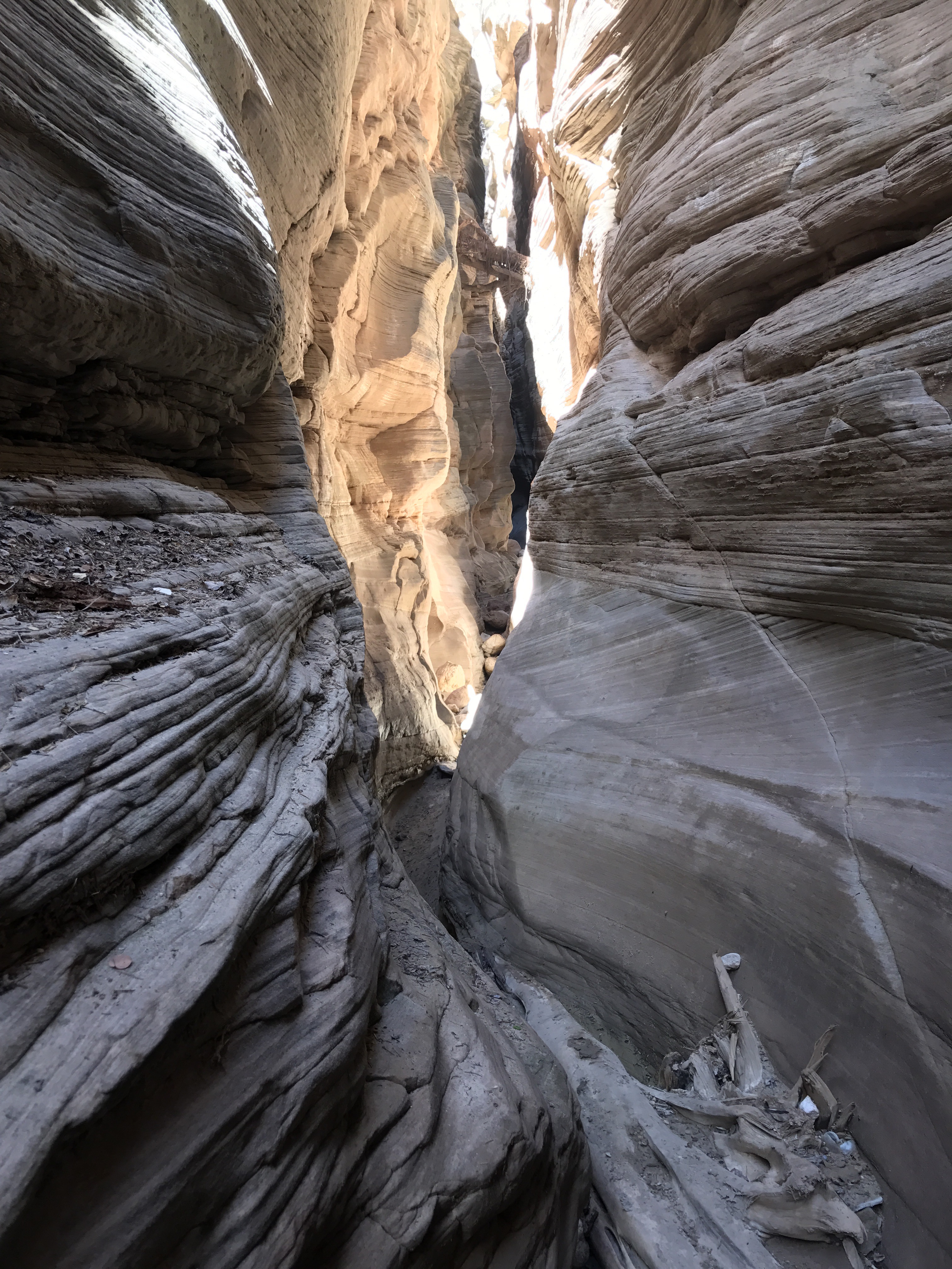
The narrowest spot I think I’ve been through.
I kept going, finding a spot where someone had bolted a climbing rope to the wall to help get up. I was super thankful it was there! I heard some echos up canyon and around a bend was met by a father and two teenagers from Sacramento. We were just about to pass under the Skutumpah road above and they told me to take a close look as I passed under. There was an old pickup stuck in the canyon walls!
Sure enough as I passed under the road- which isn’t really a bridge of any sort, just an earth and log fill- I looked up and saw the crushed pickup, suspended about 100 feet off the canyon floor and about 50 feet below the rim.
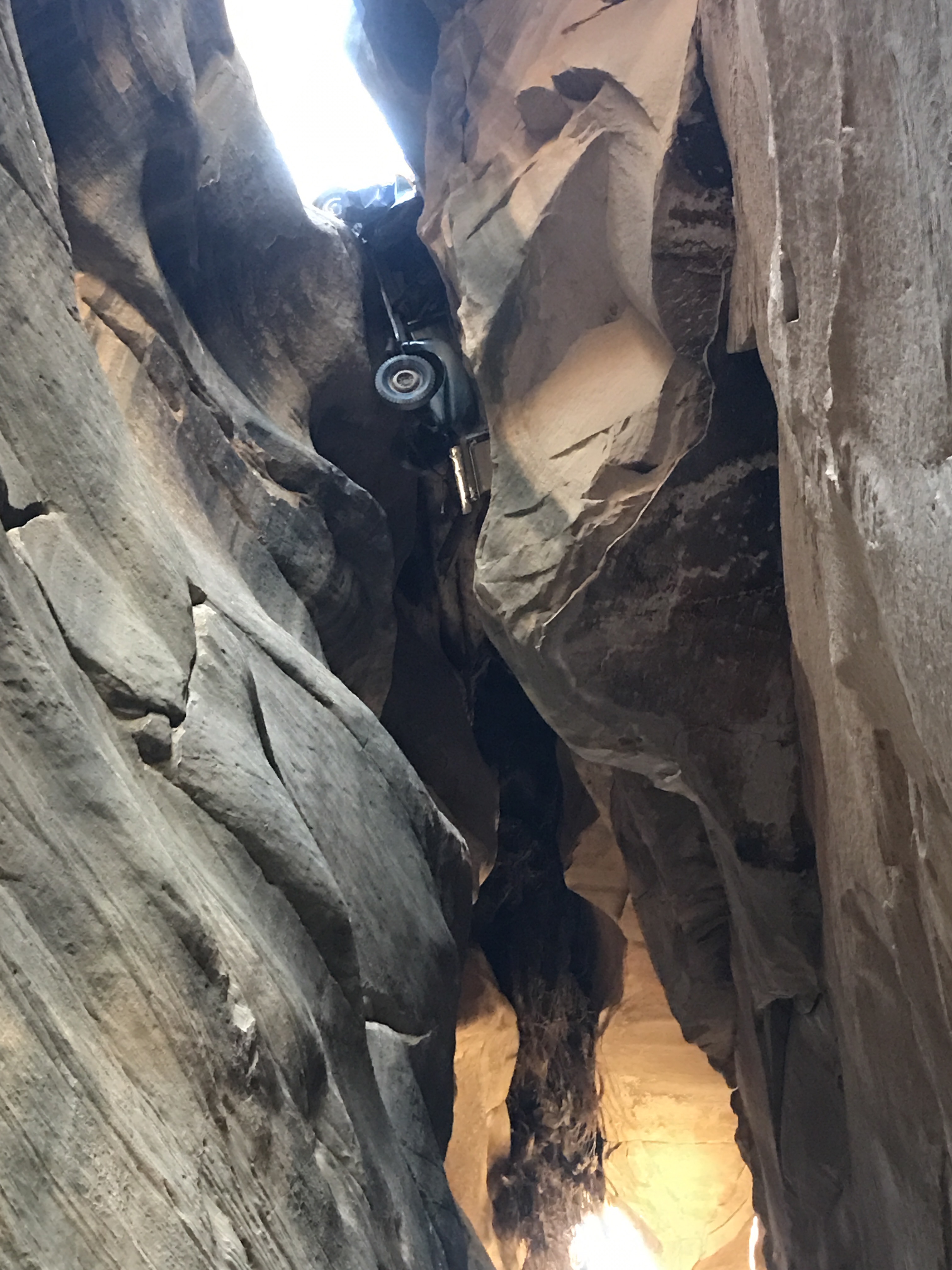
Crushed truck suspended 100 feet above the canyon floor.
From here the travel up canyon slowed considerably. There had been a few easily avoidable potholes down canyon, but I suddenly started hearing rushing water and around a corner there was a stream flowing down the center of the canyon. So much for dry feet.
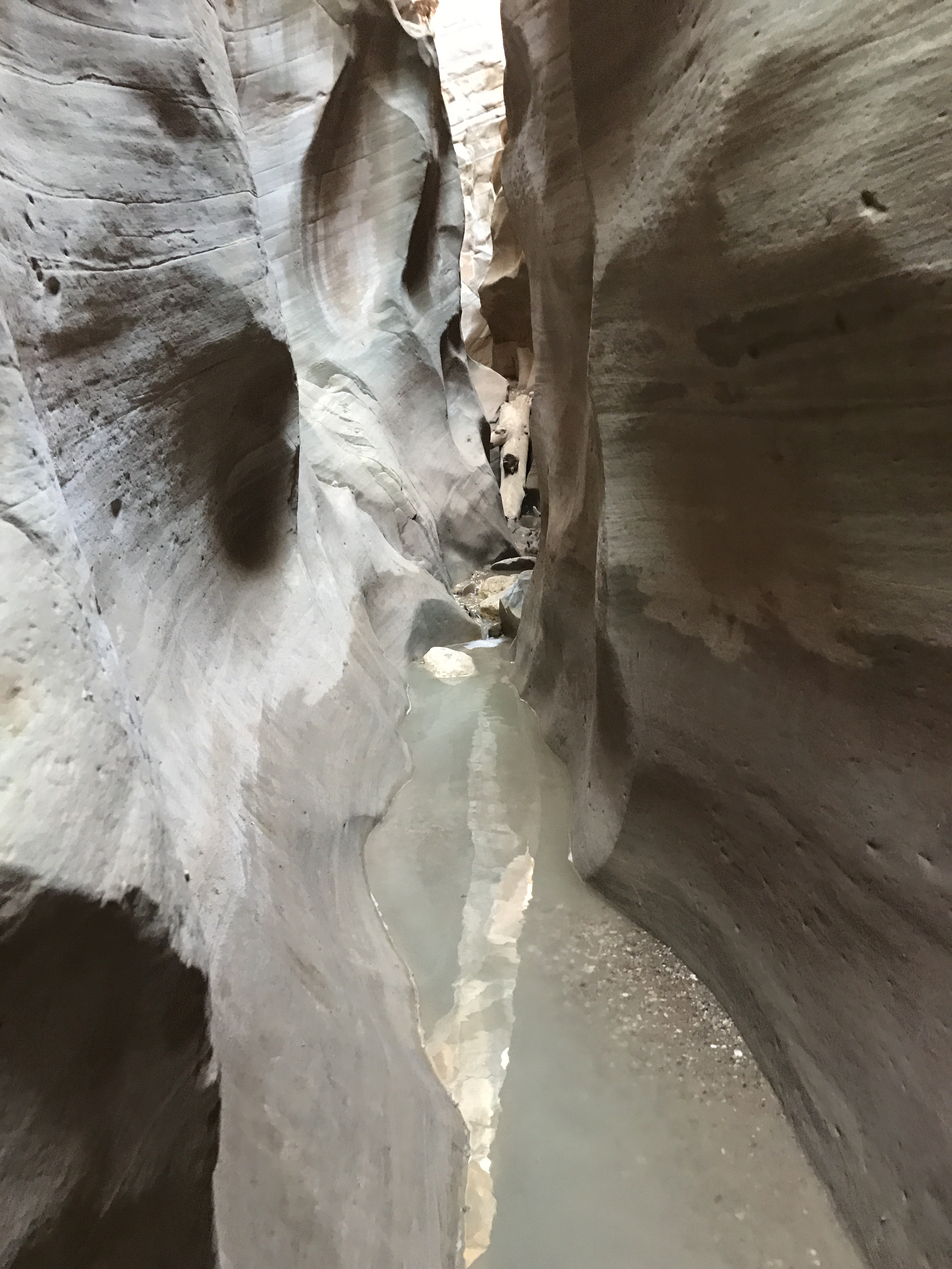
Cold flowing water.
I wasn’t quite sure what to do, and started prepping my things to keep them dry when the dad and teens came back up behind me. They were actually the ones who placed this rope!
The boy waded in- the water up to his knees (thank goodness) and climbed up first, followed by his sister. It was then my turn. And well, It wasn’t my most graceful climb, but I got up:
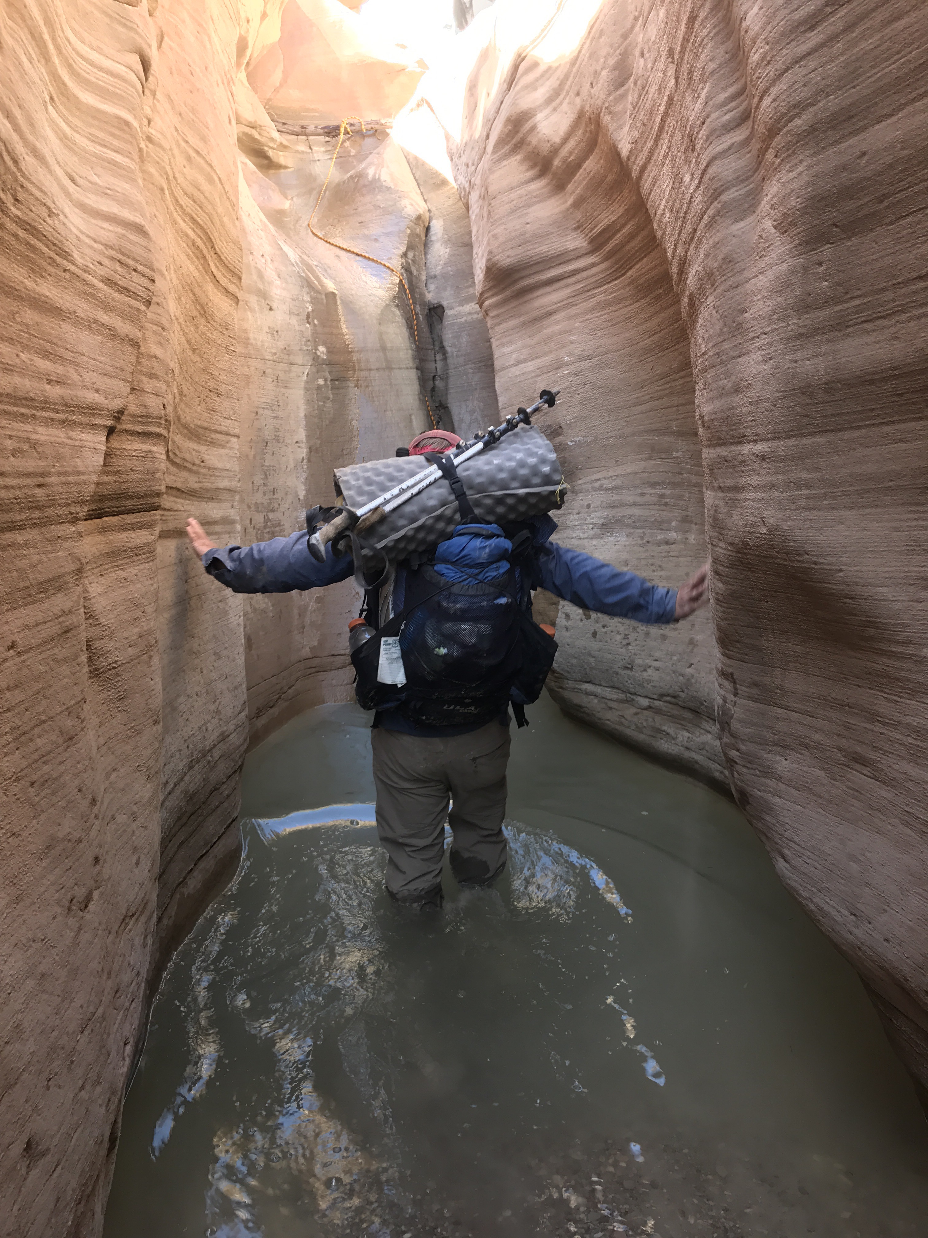
Wading through the pool.
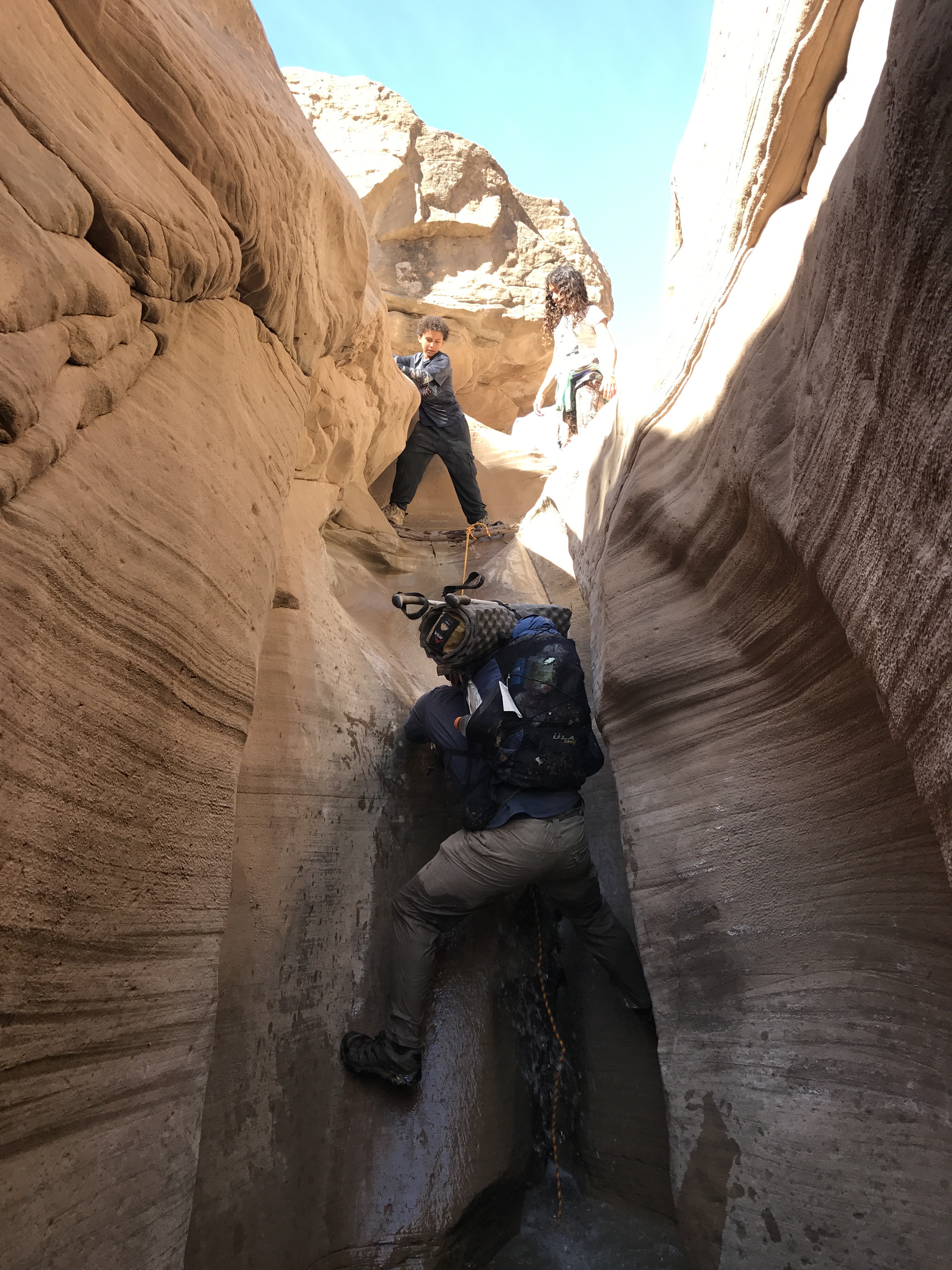
Half way up and getting a little soaked.
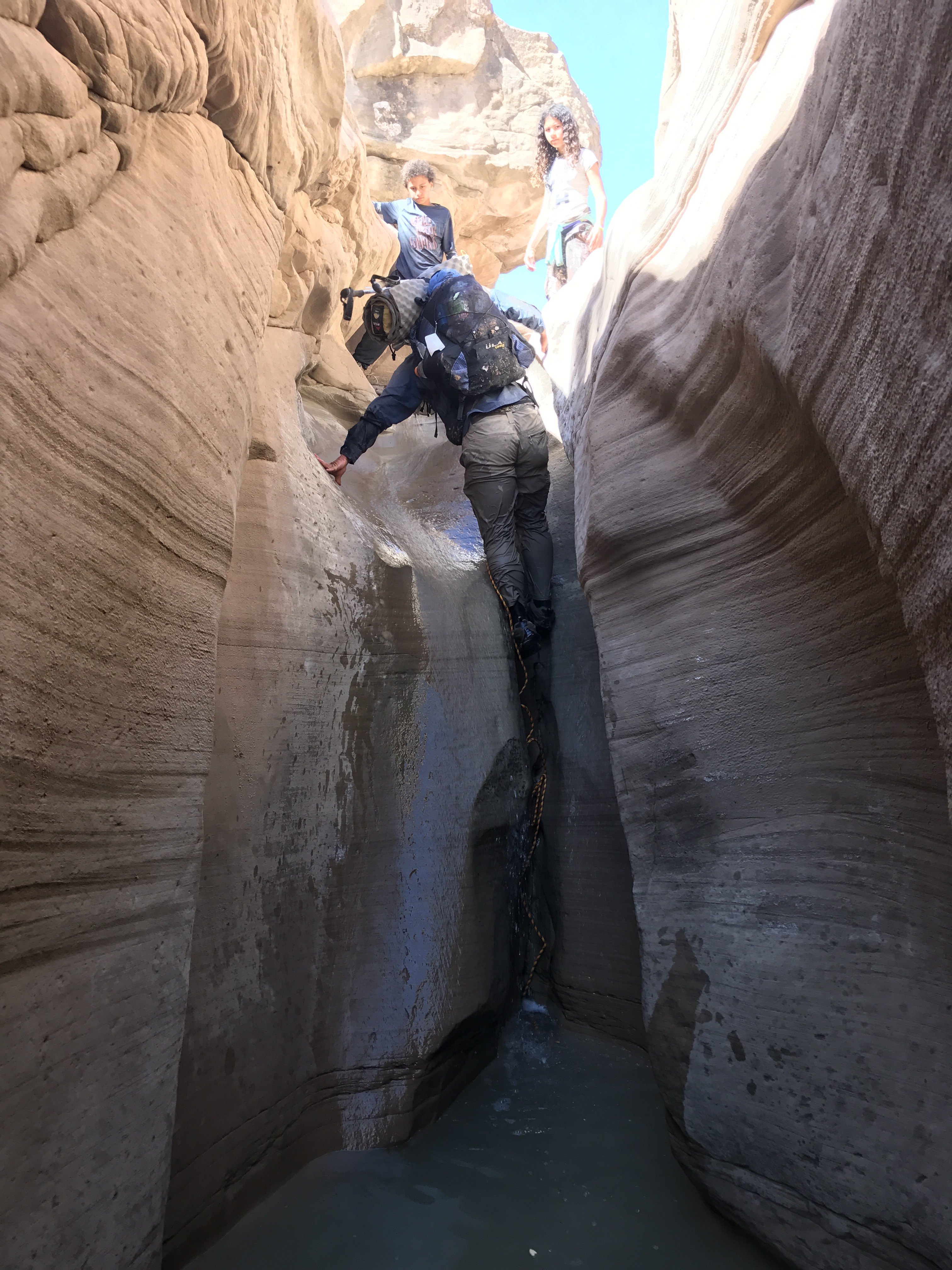
Made it!
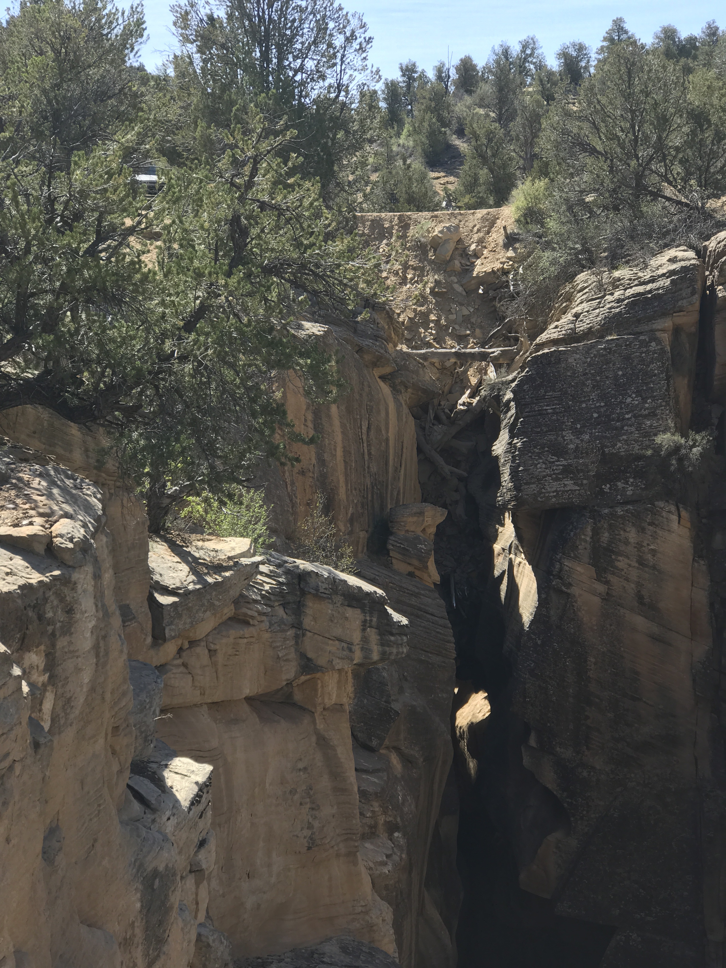
Skutumpah Road over the canyon. The glint of the trucks chrome is just barely visible in the shadows.
Willis Creek is another beautiful Narrows section, and seems to be pretty popular. There’s a creek that runs down the center and it’s pretty flat, so none of the crazy drop offs like in Round Valley or Bull Creek. I ran into 12 day hikers and a group of 10 equestrians in the canyon that alternated between nice slots and more “open” sections. I’m still amazed at how many people I’ve seen these last two days, but I guess that’s what happens where you’re closer to the road systems.
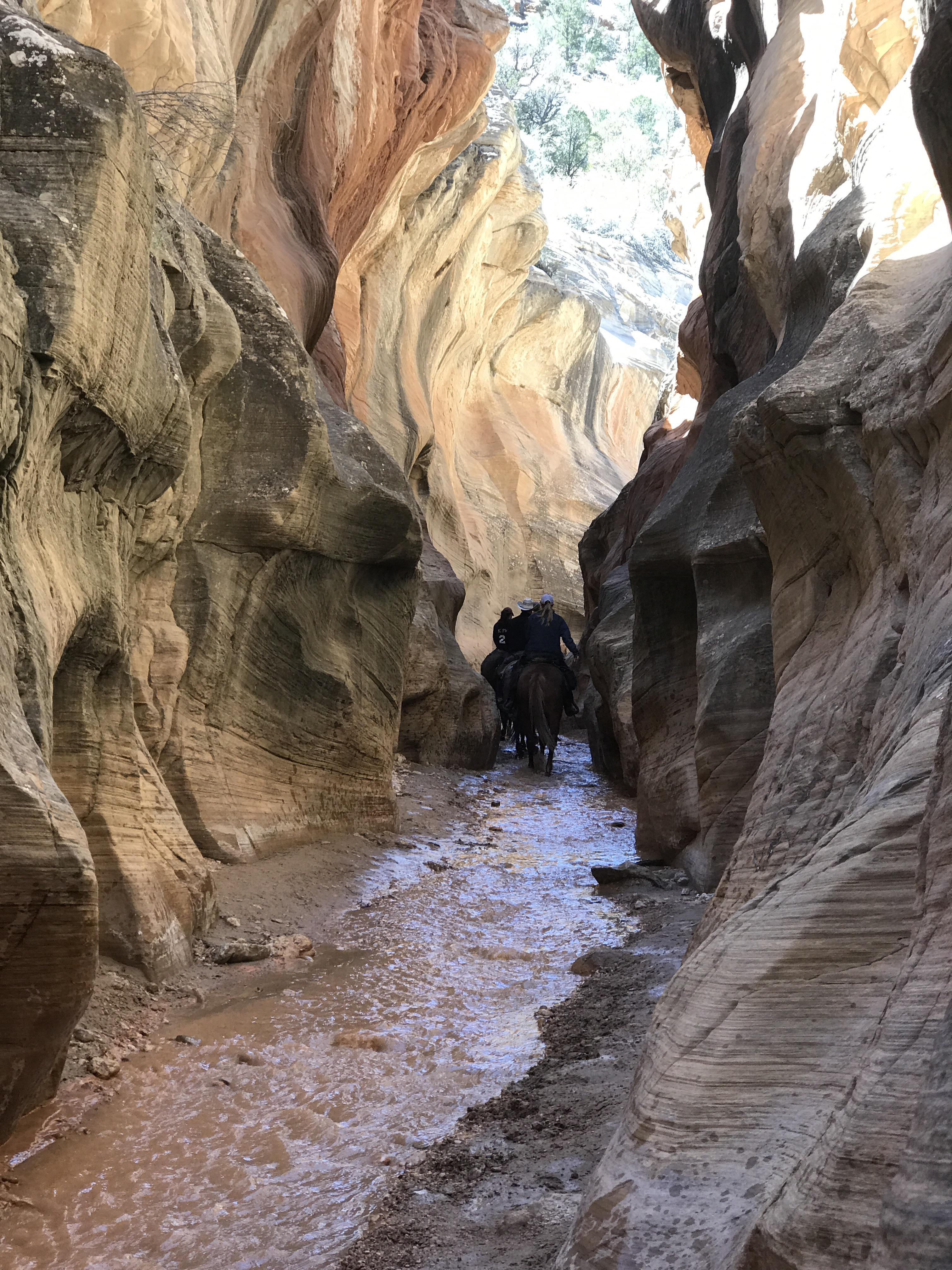
Of course I ran into the horse train at the most narrow point in the slot.
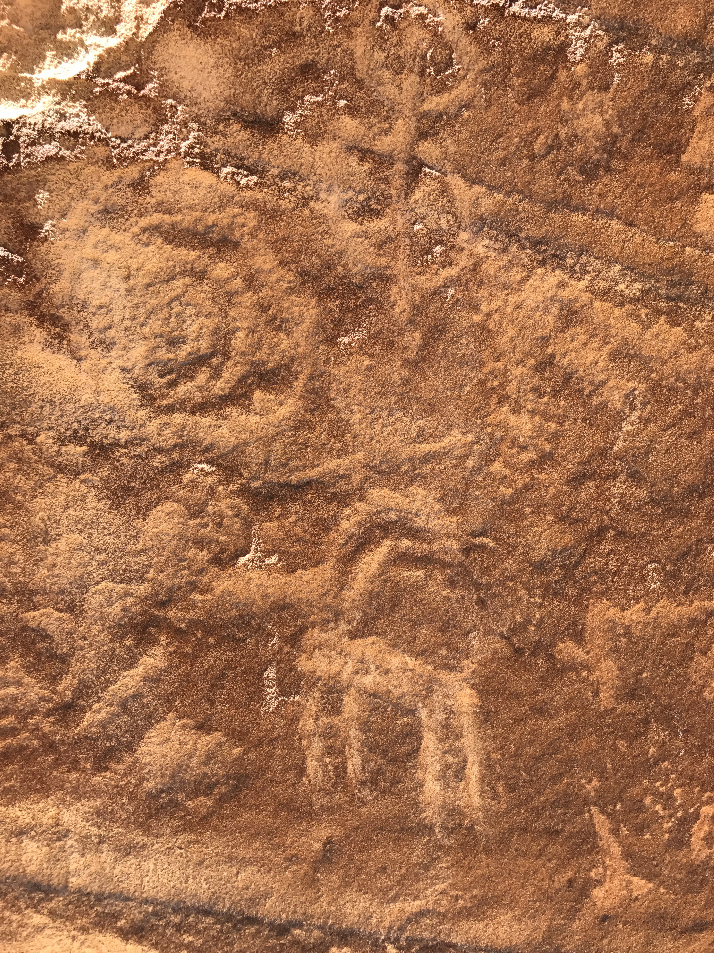
Ancient petroglyphs
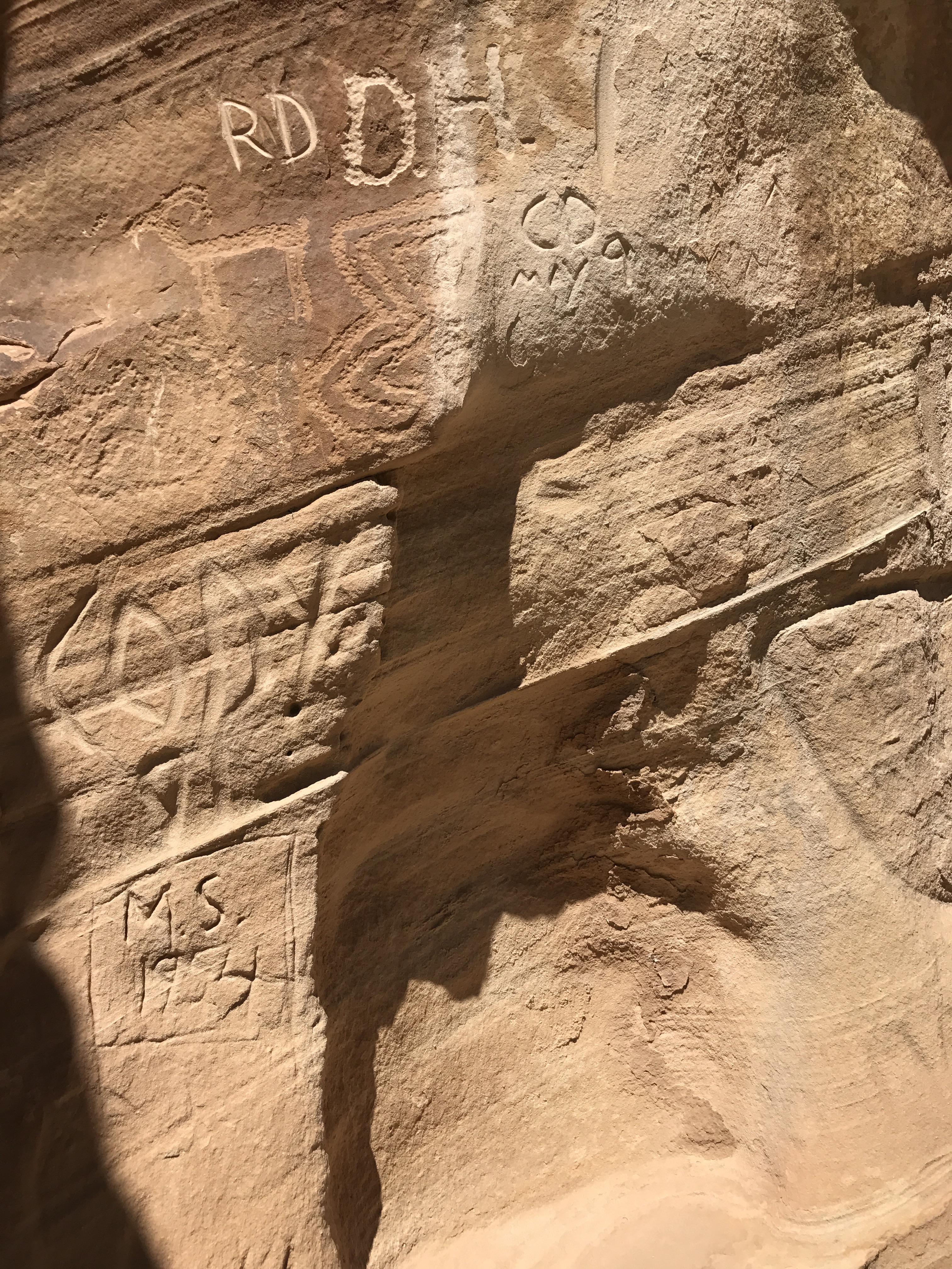
Modern graffiti
Finally pulling myself up I was back up Sheep Creek for 2 miles to where I reconnected with the Skutumpah Road which reconnected with the Cottonwood Creek Road which brought me into Bryce Valley and Cannonville.
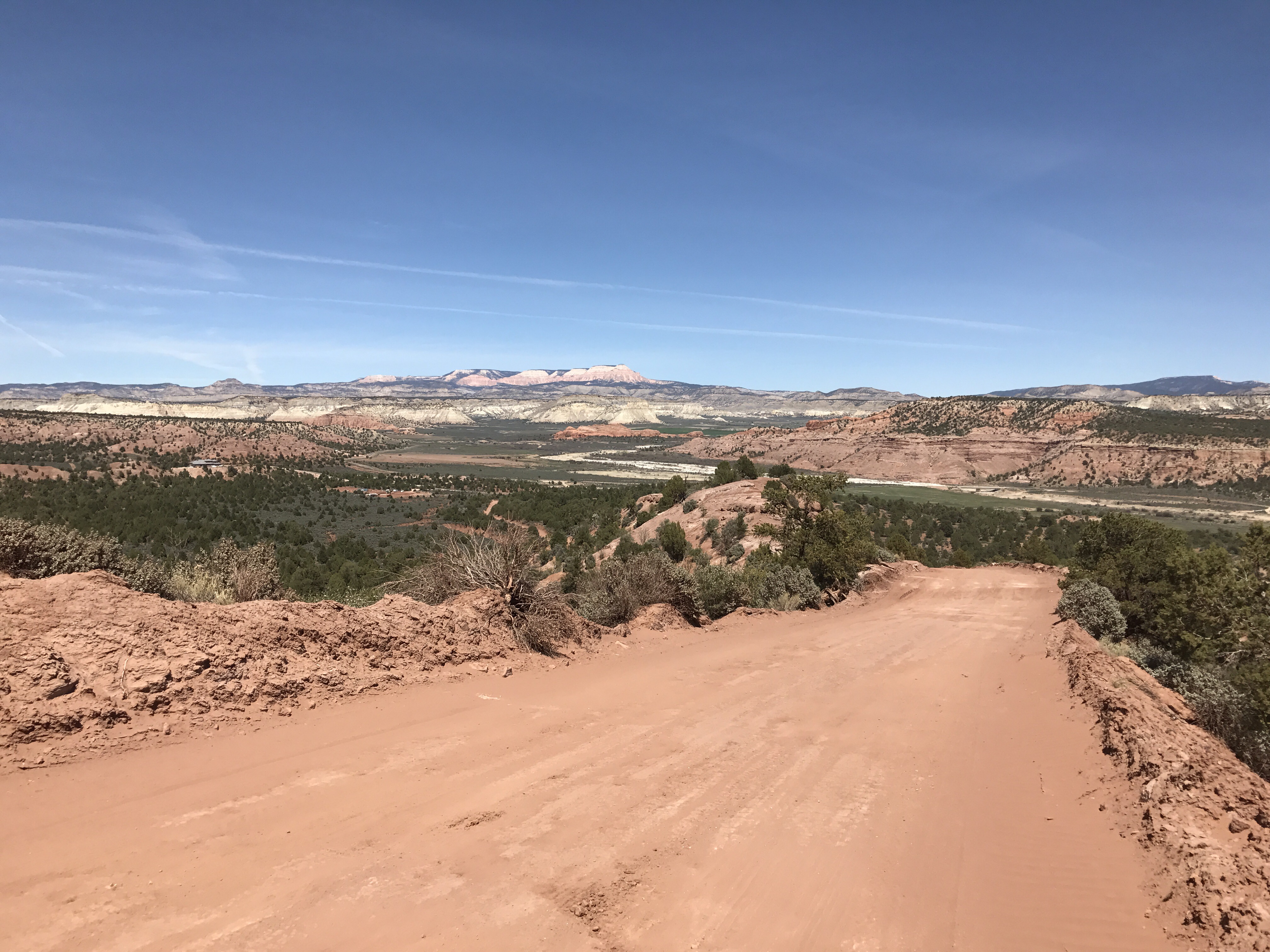
Bryce Valley with the Paunsaugunt Plateau behind
I got to town around 4:00, made a quick stop st the Grand Staircase-Escalante national Monument visitor Centre before heading to my my all in one hotel/gas station/convenience store with a BBQ food truck around back as the only restaurant in town.
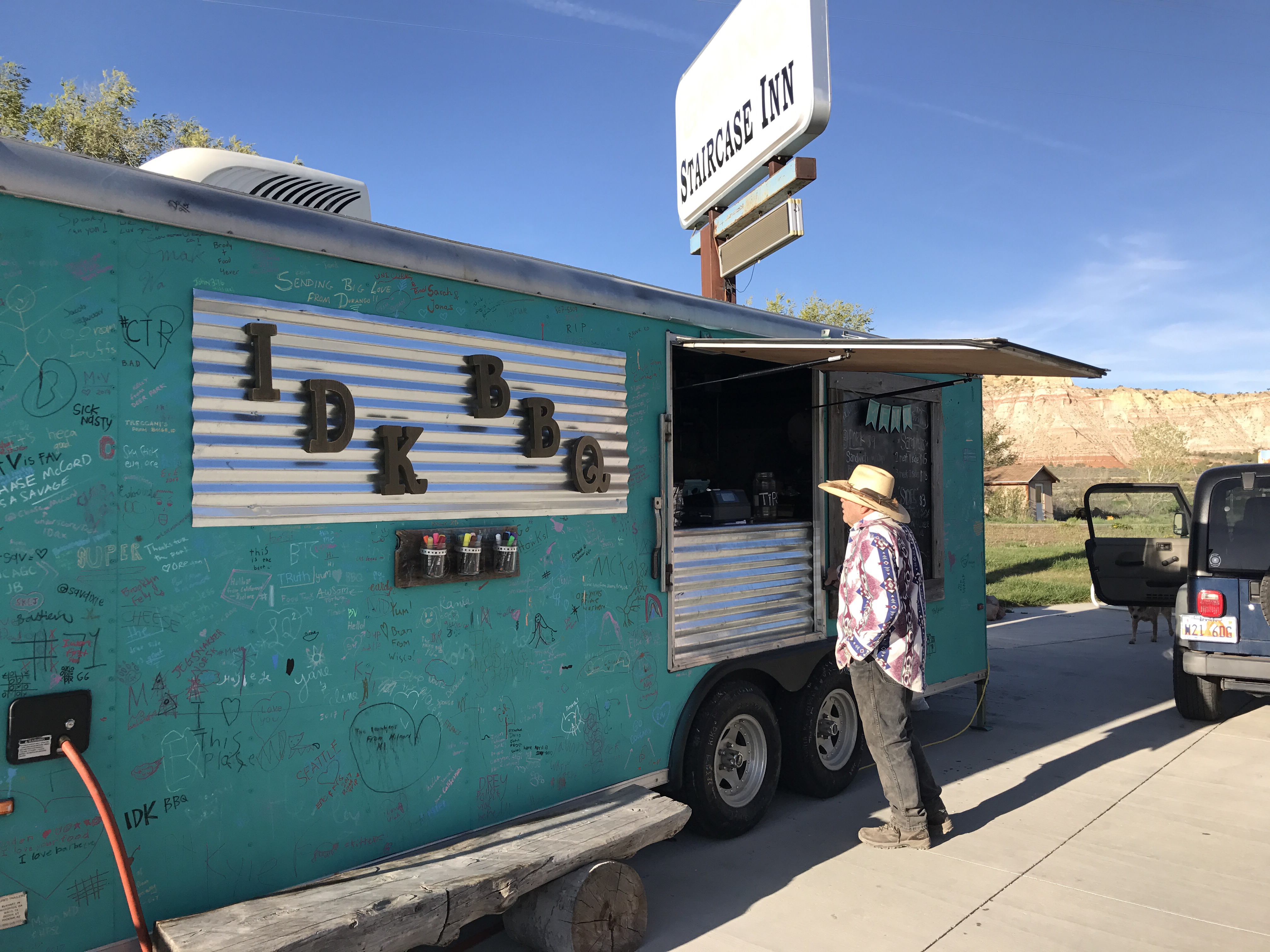
I had double dinner here- the only eatery in town.

Oh my goodness! So I had to go back through my photos because I totally didn’t recognize the spot with the rope in your photo. When we went through there was a) no water flowing down that drop and b) no rope because there was a big ol’ log situated vertically in that slot that we could easily climb up. Amazing how different things can be! Also, great photo of the truck!! Glad you got a chance to rest up in Cannonville!
LikeLike
My hiking buddy Greg and I drove from Grand Junction (CO) to Willis Creek on Saturday, April 22. We drove in from the west (Bryce), so we passed you in Tropic on Saturday, probably? (We didn’t get there until about 3:00 pm). I noticed the horse tracks in Willis Creek, which you saw on Friday. We camped at the Willis Creek parking lot–the only day without wind!
On Saturday we went to Escalante and backpacked from town to Hwy 12, which is 15 miles of awesome canyon scenery (but you already know a bit about canyons, eh). We also explored Peek-A-Boo slot and Upper Calf Creek Falls. So much to see (for those of us who don’t have two months)!
Last year, we spent 5 days in Coyote Gulch, just a week after Drop N Roll went through (in five hours!).
Kurt in Colorado
LikeLike
You probably did pass me in town! That sounds like a great trip Kurt! The photos of Upper Calf Creek Falls I’ve seen in postcards look fantastic. I’m glad to hear you had a great time.
LikeLike
Daybreaker! We stopped at the Cannonville visitor center this afternoon. I picked up a guide to the rock art. Happy to share when we cross paths!
LikeLike