
Map Miles: Today: 24.6/ Total: 455.1
GPS Miles: Today: 26.2/ Total: 483.8
Today’s Miles Sponsored By: Carl, Kiira, Chris, and Teresa.
Sometimes days just kind of slip away in their beauty and pleasure. Before you know it you’ve been sitting staring at a rock for an hour and feel totally ok with that. Or you end up hiking til after sunset, and that’s fine too, because you love watching the rocks and sky change color together.
Today was great. So many beautiful things. It’s hard to even remember back to the morning! The final Miles in Hackberry Canyon went by pretty quickly. The walls narrowed in considerably again, to the point where I had to walk through the creek! At the same time, the walls changed back from the bright red to the more muted yellow and beige tones.

The return of the Narrows in Hackberry Canyon
A few turns of the canyon later, and I was back to Cottonwood Creek Rd- the same one that went by Grosvenor Arch! I continued upstream for just a bit and then turned off on an alternate route up and over Yellow Rock. So much of this last section has been down on the creek and Canyon bottoms, I really wanted to get up to a birds eye view of the place. The trail initially was steep. Much steeper than I expected it to be. Fortunately that didn’t last too very long and you were up at a saddle at the top looking out over Yellow Rock.
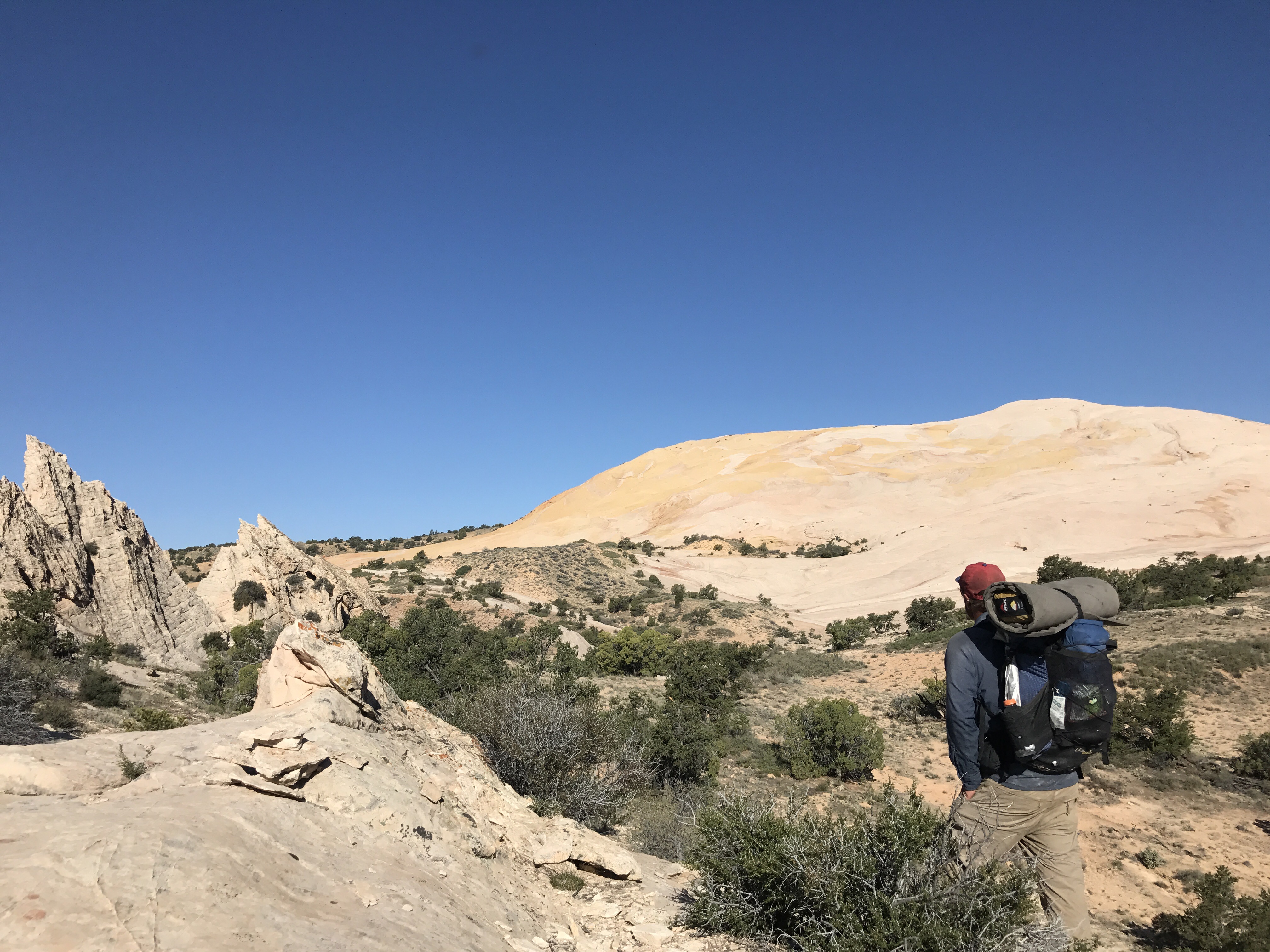
Yellow Rock really blew me away.
I stopped. It wasn’t what I expected at all. Yes, mostly yellow, but also stripes of white and waves of coral, and splashes of salmon. It was awash in color, and not just Yellow Rock but the whole surrounding countryside. The green of the valley floor to the east, multicolored beauty to the sout, the deep red of the canyons walls back north and west. I just sat down for a long time and stared.
Finally ready to move I began the climb up. There was no need for cairns to the top. You could just pick any line and follow it up to the rocks high point. It was super cool walking along the waves of yellow.
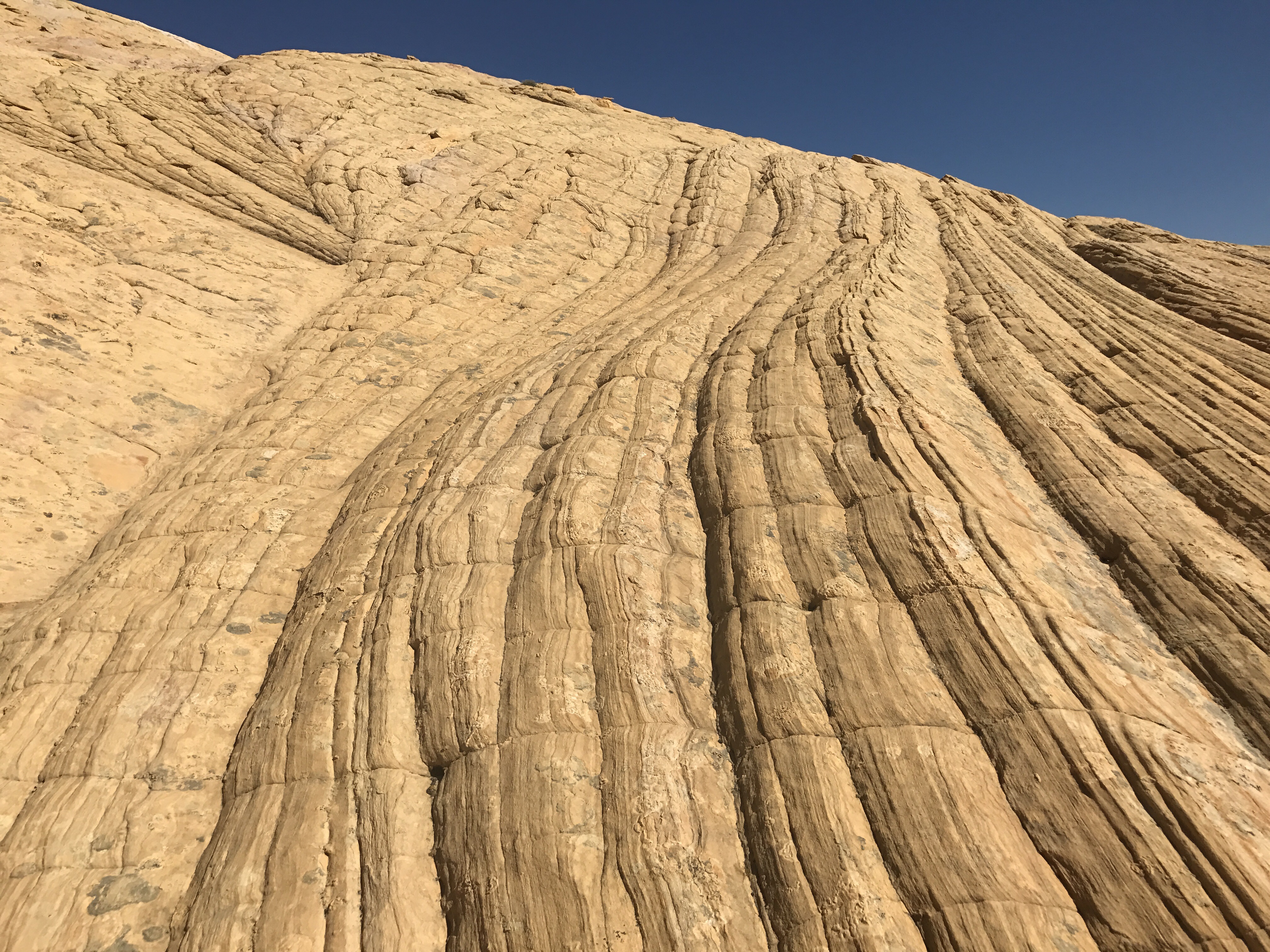
Waves of yellow.
And the view from the top. Again, just something else. I would have been happy just to sit up here all day.

The iPhone panoramic photos just don’t capture the full majesty
Alas time dictated that I must move on, and so I dropped down the North side and picked up the surprisingly well marked trail all the way down to the Paria River.

First view into the Paria Valley.
On the way down I finally had 2 lizards sit still long enough for me to photograph them!
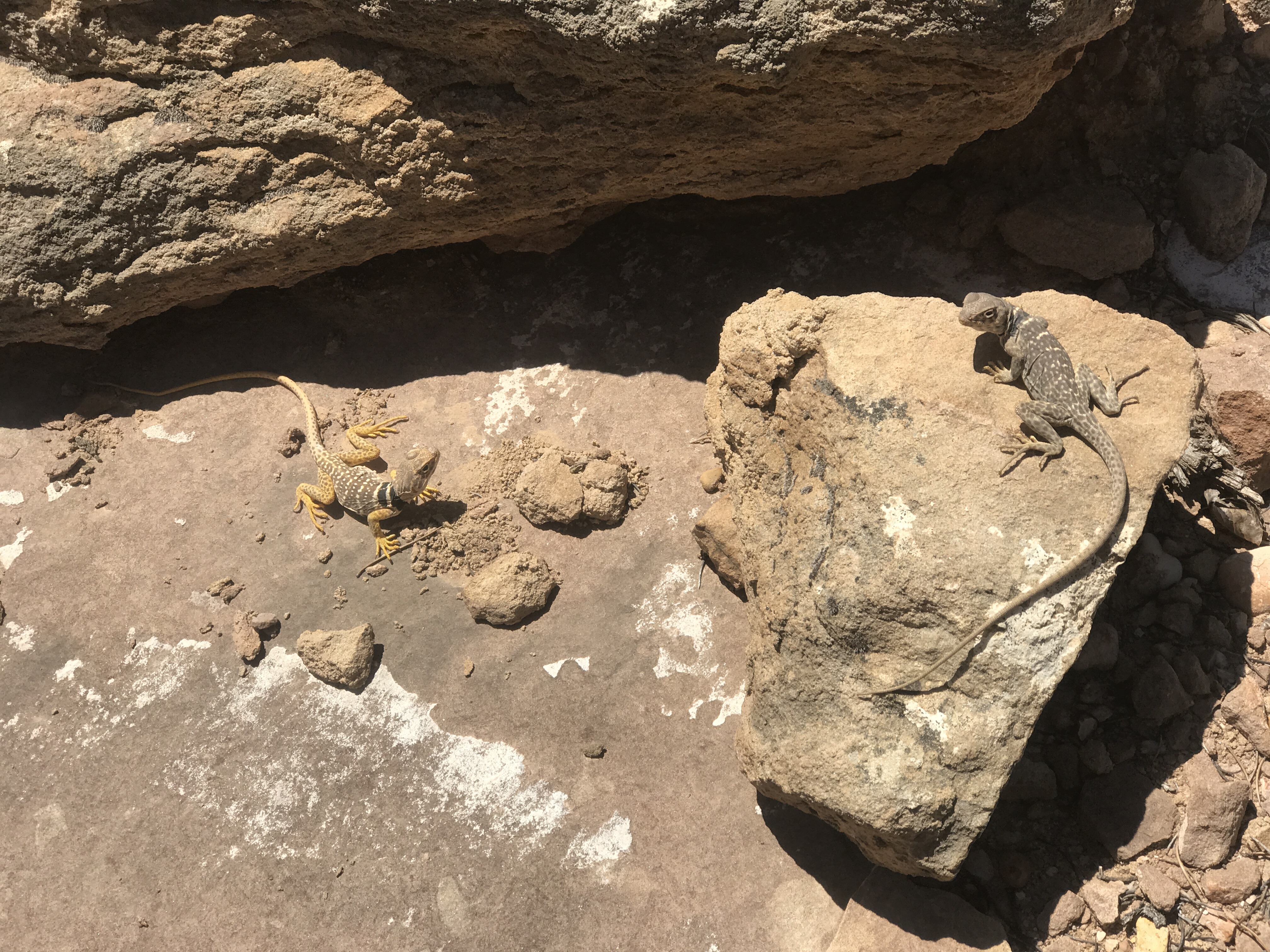
I guess these two aren’t afraid of people- though they are about twice the size of most of the other lizards I’ve seen.
Lots of folks I meet out here ask about the wildlife I’ve seen. I actually haven’t physically seen very much. Without a doubt lizards are the most common as they scurry and scuttle out of the path rustling off to hide in the brush. Cows are probably next most prevalent followed by rabbits. There’s not much else I’ve seen with any consistency- physically anyway. (I’m super jealous of my friends Marmot and a Gabriel who got to see four of the Henry Mountain Bison!!!! Also check out their blog! They’re about a week behind me and have lots of cool stories and info- especially about the local geology and flora. I hope our paths can cross somewhere before the trails end)
Now tracks are a different story. I see tons of tracks. Coyote, cougar, small rodents, deer, the list could go on and on. And then there were these that I ran into today…what are they?

Some kind of bird? Upright reptile? ID help!
The Paria River starts off with a super wide flood plain and it braids itself across the entirety of it.

The flood plains of the Paria
The surrounding canyon walls again are like nothing seen before. Stripes of pinks and browns and reds and greens and whites and yellows. Like a mottled calico cat hillside. About a 20 minute walk up the River is the abandoned Mormon settlement of Paria.

The most intact structure I could find. Old house with root cellar.

Paria Cemetary and Memorial
Very simple and gated with a more recent Memorial in the middle, since none of the gravestones are marked. Many of the names listed died very young. It can’t have been easy living here.
While lunching, I ran into about 10 other folks who had come by to see the townsite. There’s a road to the area that I guess is relatively accessible.
Again, I could have lounged around for much longer, but time dictated I move on. The rest of the day’s walk was up the Paria River. Mostly in the winding riverbed, but sometimes cutting across the meanders on old jeep tracks.
Because the flood plane was so wide it was usually possible to find good walking on solid ground, though near the river crossings you still sometimes ended up in the mud.

Mud prints.
Now I’ve talked about mud for a little bit these last few days. It’s not you’re typical squishy backyard after it rains mud. This is sink ankle deep into the ground mud and pull up about a pound of it on the bottom of your shoe. Or it’s have your foot slide sideways across the top surface mud. And the more of it on the bottom of your shoes the more likely you’ll be to slip and slide. You can try to gauge based on color where the firm spots and the muddy spots will be, but it’s not always possible. The only true marker is the presence of other folks deep footprints.
Up the river I continued, noting all the animal names for the side creeks and canyons- Hogeye, Snake, Deer, Sheep, Bull Valley. The wind got strong at times as it whipped the drier sand off the hills and straight at me. The calico hills eventually gave way to red and the red eventually were taken over by a yellow layer above. It was really awesome to watch the yellow rock first appear at the tops of the canyon walls and slowly come down lower and lower.

Back to the gorgeous deep red cliffs.
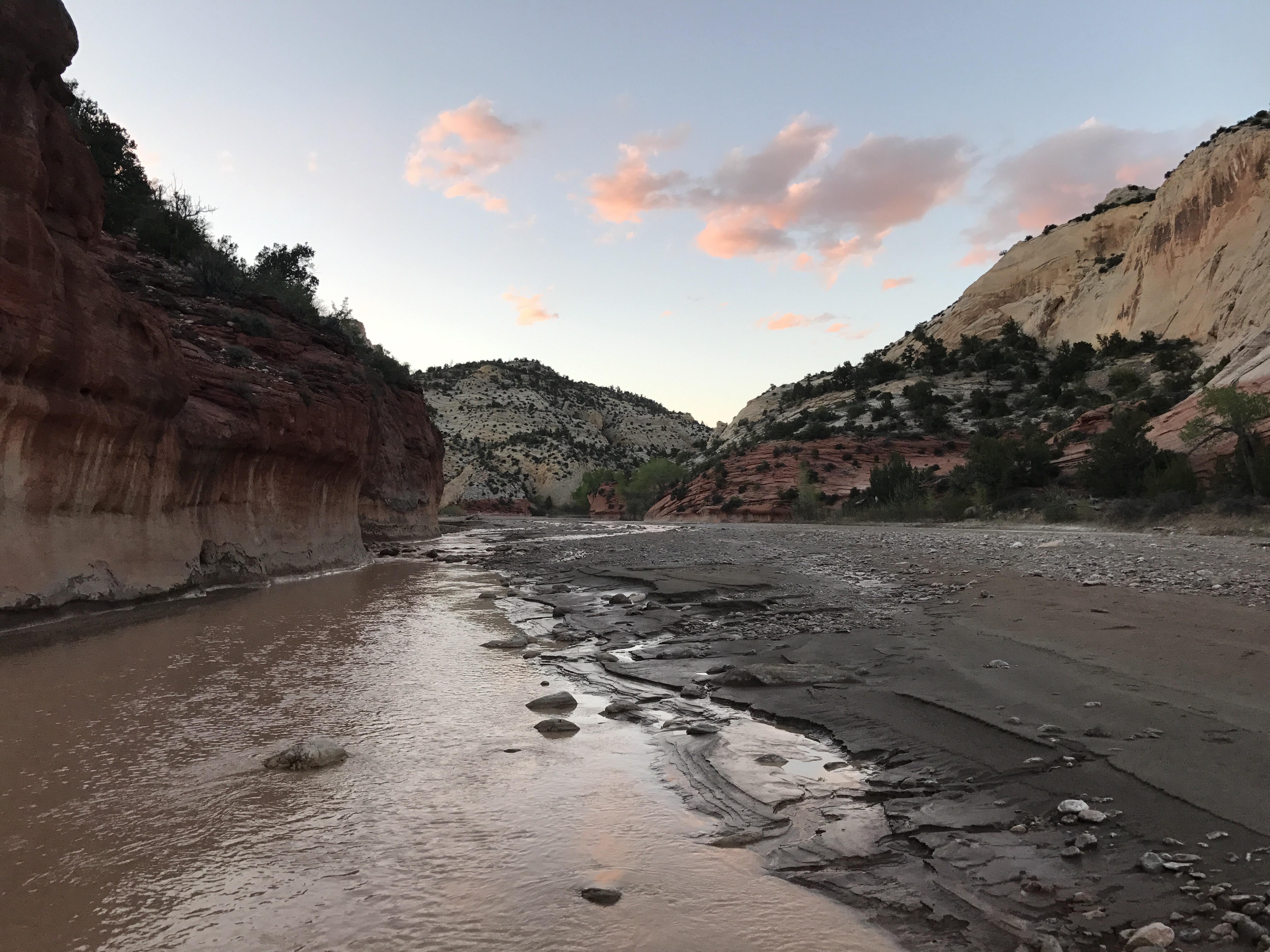
Around 6:15 I arrived at my hopeful camp spot, a mark on the map that denoted a piped spring in a crack in the western wall behind a grove of cottonwoods. It’s supposed to be good clear clean running water- one of the best sources in the area. The Paria is brown and silty and filled with agriculture runoff from the upstream towns, so – even filtered, it should really only be used as a final resort.
There were many cottonwood groves, so I dropped my pack and walked back and forth up and down the western wall for a quarter mile investigating deep into the brush behind the groves. I never found it (though I have since see a picture so I at least know it exists somewhere!). I was a little frustrated. I had enough water to cook with, but that was about it. The prospect of drinking from the Paria didn’t seem appealing and the next Creek was another 3 miles upstream and was said to be possibly a little cleaner than the Paria. It was about 7 by this point so I would have just enough time to get there before dark. What the heck, I figured. It’s been a great day. My feet felt good. Three miles isn’t much at all.
Sunset is coming as the yellow rock layer takes over.
The sunset began to light up the clouds as the yellow rock layer slowly descended and right where it took over I turned off onto my side tributary canyon- which was unfortunately no less silty. With no daylight left, I found the first flat place I could and threw my pack down to set up camp.
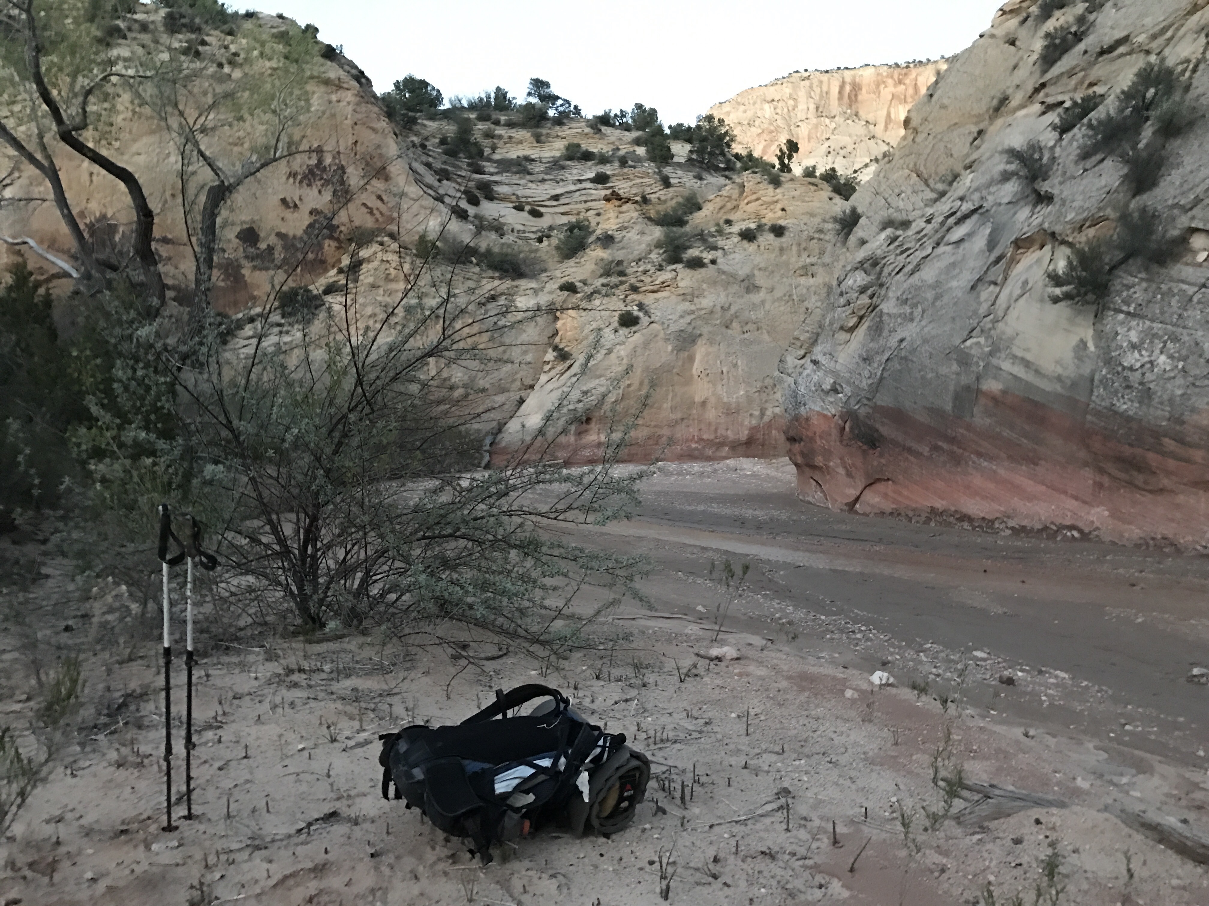
creekside spidery sand camp
I’m not thrilled with the spot, but it’s what I have. Sand camping is never great. I started trying to cowboy, but after the fourth crazy huge crazy fast sand spider rushed at my headlamp and campsite I decided to set up the tent. Big spiders just aren’t my thing. So here I am nestled in my tent (but still able to star gaze! Why set up the rain fly if there’s no rain?) still in awe from all of today’s travels. What beautiful special country this is.

Lovely photographs! I have only been blogging for about a week now and I would really love your opinion on my latest post…https://strumonlineblog.wordpress.com/ – It really would be greatly appreciated- Thank you 🙂
LikeLike
I ❤ the Paria! So glad you got to enjoy it on such a lovely day.
LikeLike