Map Miles: Today: 9.1/ Total: 1004.1
GPS Miles: Today: 10.3/ Total: 1060.1
Today’s Miles Sponsored By: It Could Be You! Donate Today!
Where do I even begin to try to capture my emotions on today. The final day. I’m not sure quite how to do it. Maybe that’s because it still hasn’t sunk in. Maybe it’s because I’m actually still down near Zion for another night instead of celebrating in Vegas, so it doesn’t totally feel like the end. (We’ll get to that in a bit). Maybe it’s because, to be truthfully honest – it’s not really an “epic” finish ending in a small parking lot on the side of the road in the lesser frequented Kolob Canyons section of Zion. My final day on the PCT was a 30 mile trudge through snow and sleet and rain. Cameras waterlogged and broken. Unable to feel my toes, and my fingers so numb I couldn’t even grip the pen to write my name in the trail register. The joy of finishing heightened because the conditions were so miserable.
In contrast, today was a 10 mile walk. Relaxed. Time to take one last side detour. Time to savor. Done by mid-day. Ending at an obscure parking lot look-out. In that way this finish on the Zion Extension feels exactly like it should for the Hayduke. So much of the route is through these littler known areas – to even visit the high traffic spots of Arches and Bryce and the Grand Canyon I had to go off the guidebook route. To finish at the Weeping Wall with all the people around is definitely a bit more “classic” but maybe a bit less “Hayduke”. Finishing at Lee Pass felt very “Hayduke”. Whatever the reasons, even if it felt right, even if I was smiling and joyful and proud, that doesn’t mean that it still didn’t feel a tad anti-climatic.

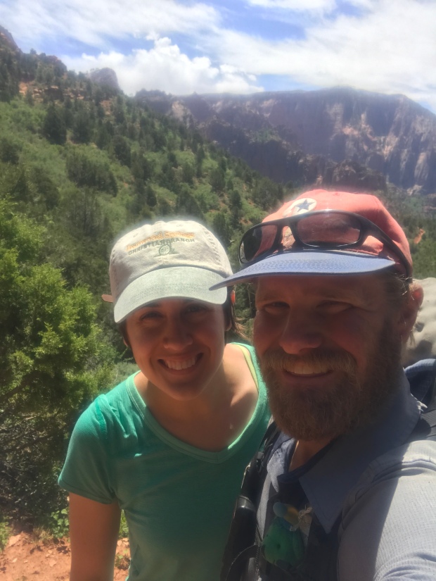
Laura striking out for the day.
It was good that we had such a relaxed day ahead for us, because I didn’t sleep very well last night. The flies and mosquitoes did their trade off again and my mind wouldn’t really quiet down. And it was still uncomfortably warm. Laura didn’t even bother to put her rain-fly up.
Our first mile took us off of the fantastic Hop Valley Creek we’d been following yesterday, out of the meadows and up into the forest before dropping down a set of switchbacks to La Verkin Creek. The heat had finally broken towards dawn and overcast skies hid the sun and kept our temperatures cooler – a blessing after our loopy afternoon yesterday. We were even wondering if we might get a little bit of rain. The gray clouds were also a great contrasting background for the red and white cliffs we were passing through adding an extra pop to the colors.

Looking out over the beautiful cliffs and unique swirl-y rocks. PC: Laura Weiss
Just after hitting La Verkin Creek we dropped our packs (hoping they wouldn’t get raided by squirrels) and took a half mile side-trail up to Kolob Arch. While Kolob Arch is the 6th longest known arch in the world (Only 3 feet shorter than Landscape Arch in Arches National Park!) it’s thick walls, positioning close against the cliff behind it and viewpoint from far below through a dense brushy forest make it one of the less spectacular ones I’ve seen. Definitely worth the side trip if you’re already going to be so close, but maybe not the 12 mile roundtrip day hike destination that most people do it as.

Lydia’s Geopet at Kolob Arch.
Our side-trail complete, our water collected for the last few miles, our minds wandering to the end we (I?) intentionally slowed ourselves down. At times literally stopping to smell the flowers. No need to rush the end – I wanted to savor these last hours of being in the desert and the woods and the wild before what I imagined would be a jarring transition back to “civilization”. Silty La Verkin Creek provided our music for the first bit before we turned off and began our slow gradual climb up to the trailhead.

The “falls” of La Verkin Creek. PC: Laura Weiss
On the ascent we began running into the day’s fellow hikers – some the backpackers heading to Wildcat, some the day hikers heading for the arch. Even a group of three park rangers who checked our permits. It’s always a satisfying feeling to whip a permit out and show that yes indeed, we are legit to be there. They seemed surprised about the distances and speed we’d traveled. They were also able to answer a bunch of the questions that we had had from the last few days! Information about the random climbing rope hanging above the Emerald Pools (left over from a rescue the previous week) and the house inside the park on Kolob Canyons Rd we saw yesterday (built about 3 or 4 years ago.) and the cattle grazing inholdings in Hop Valley. We also ran into an older couple who turned out to be the parents of one of the two women who had attempted to day hike the entire Lee Pass- Zion Canyon section! We were relieved to hear that they did indeed finish – around 10:30pm that day.

Slow and steady on the final uphill.
As we ascended up to the Pass we began getting more and more commanding views of the Finger Canyons and the rolling green lands stretching behind us. The cut of the road we were heading for suddenly became visible on the side, and allowed us to judge our distance to the end as the gap slowly closed. And then, once the sun glinting off the parked cars and the people staring down from the lookout were visible, the ending truly inevitably in reach, I sent Laura ahead with my camera so she could photograph my final few steps.
I sat for a moment waiting for her to get ahead, and trying to collect my thoughts and emotions. Pride I think more than anything was what coursed through me. Physically this trail was about what I had expected it to be, but mentally, it had been a huge challenge. I’d struggled a bunch with the loneliness. While the thought of quitting never once crossed my mind, I still felt an enormous amount of pride in the completion. I’d pushed myself and learned about myself and succeeded in reaching my goal. I’d seen places few will even think of getting to. I’d seen sights that will forever stick with me. I’d been supported by and met amazing people along the way, all traveling with me in my heart.
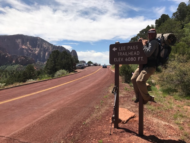
I took some breaths and stood up. A smile on my face that couldn’t be wiped off. The goosebumpy adrenaline high feeling in my head. I rounded the corner, and there was Laura by the end sign ready to greet me and congratulate me and taking photos and giving hugs.

The last steps.
Two pairs of shoes, four broken water bladders, and 1,060 miles later. A (rches) to Z (ion) finished. My Hayduke complete.

Finished!!!!!!!
And then it was done.

From beginning at the airport to ending in an obscure roadside trailhead. What an adventure.
Or was it?
At the road we were suddenly in a cell reception area and my phone dinged. A surprise message from Marmot and Gabriel! They wanted to know if they finished tonight at The Weeping Wall if they could hitch to Vegas with us. Not only would I get to celebrate with Laura but I’d get to greet these amazing friends at the end of their trek and celebrate with them as well. It didn’t take Laura and I much time to decide. Of course we’d wait for them!

Panoramic view of the Kolob Canyons from Lee Pass
So our plans changed. Laura and I got a hitch back to Springdale with the third car that passed, a woman named Katharine who was just beginning her own sabbatical. An awesome 3 month long National Park road trip through Utah, California, Oregon, Washington, and Montana. More kindred spirits. The ride flew by in conversation about places to visit and things to see. We exchanged info and hopefully I’ll see her on her trek through Seattle too.
In Springdale we had lunch at a great little fresh cafe in town and created a new itinerary. After some more sporadic messages back and forth with Marmot and Gabriel we discovered they wouldn’t actually be in until tomorrow morning so we needed to figure out some afternoon activities and lodging for the night. For the afternoon we decided to head back into the park and take the shuttle up to the Temple of Sinawava, the departure spot for folks who want to wade a few miles up into the Narrows.
What a great decision! We hadn’t expected the water dripping and columbine covered walls of the paved Riverside Trail. Probably the best hanging gardens I’ve seen on this trip. A great surprise treat.

The amazing hanging gardens along the Riverside Trail near the Temple of Sinawava.
We stopped at the end of the trail, looking wistfully and sadly out towards the Narrows. We’d heard from the rangers that they will probably open tomorrow. It’s ok though. I learned a new phrase on this trail- FOMO. Fear of Missing Out. But you know it’s ok. Day hiking the Narrows, exploring The Needles, seeing Delicate Arch. Cedar Breaks and Kodachrome. I haven’t missed out. I’m leaving a reason to return. This will not be my last Colorado Plateau adventure.

Our sad faces. Some day we’ll be back to hike The Narrows.
On the shuttle return from Sinawava we were discussing what our lodging options for the night would be when the climbers sitting behind us mentioned a free “campground” on private land just a 15 minute drive away. How could this be true? But sure enough there it was. Two miles up Kolob Canyon Road out of the town of Virgin a small dirt road turnoff led us to a semi-developed first come first served campsite next to a creek. There was even a port-a-potty with a donation jar inside to help fund it. What a great find to stumble across.
So we get one more night outside. One more sunset. One more evening under the stars. One more night in the (sorta-not-really) wild. One bonus magical slow Hayduke night.

Bonus night.


Those are my beautiful mountains. I miss them so much! I grew up in Short Creek. Thanks for sharing pictures
LikeLike